|
search place name
|
||
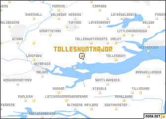
Tolleshunt Major (United Kingdom)Tolleshunt Major is a town in United Kingdom. An overview map of the region around Tolleshunt Major is displayed below.
regional and 3d topo map of Tolleshunt Major, United Kingdom ::
Tolleshunt Major airports ::
The nearest airport is SEN - Southend, located 20.5 km south of Tolleshunt Major.
Other airports nearby include STN - London Stansted (39.6 km north west), LCY - London City (56.3 km south west), MSE - Manston (60.6 km south east), CBG - Cambridge (64.9 km north west), Nearby towns ::
Goldhanger (2.2km south west) //
Tolleshunt Knights (3.9km north) //
Tolleshunt DʼArcy (2.9km north east) //
Salcott (5.1km north east) //
Tollesbury (4.6km east) //
Tiptree (7.5km north) //
Saint Lawrence (6.5km south east) //
Virley (5.9km north east) //
Steeple (7.8km south) //
Layer Marney (7.8km north) //
Inworth (7.8km north) //
Great Totham (7.2km north west) //
Great Braxted (7.2km north west) //
Mundon (8.2km south west) //
[all distances 'as the bird flies' and approximate] 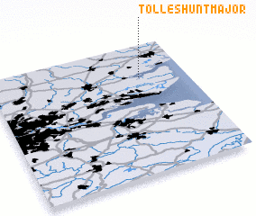 Places with similar names to Tolleshunt Major, United Kingdom :: Disclaimer :: Information on this page comes without warranty of any kind |
||
|
Where is Tolleshunt Major? Elevation and coordinates ::
Latitude (lat): 51°45'0"N Longitude (lon): 0°46'0"W
Elevation (approx.): 11m (map arrows pan, magnifying glasses zoom) |
||
|
Visiting Tolleshunt Major? Hotel/Accommodation ::
Book a hotel in Tolleshunt Major Travel Guide ::
rental cars ::
car rental offers GPS waypoint ::
download a GPX waypoint (PoI) of Tolleshunt Major for your GPS receiver
|
||