|
search place name
|
||
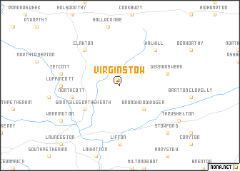
Virginstow (United Kingdom)Virginstow is a town in United Kingdom. An overview map of the region around Virginstow is displayed below.
regional and 3d topo map of Virginstow, United Kingdom ::
Virginstow airports ::
The nearest airport is PLH - Plymouth, located 35.0 km south of Virginstow.
Other airports nearby include NQY - Newquai St Mawgan (59.1 km south west), EXT - Exeter (61.4 km east), SWS - Swansea (100.0 km north), CWL - Cardiff (100.3 km north east), Nearby towns ::
Ashwater (1.9km north) //
Broadwoodwidger (4.4km south east) //
Saint Giles on the Heath (5.1km south west) //
Germansweek (5.0km east) //
Northcott (5.0km west) //
Clawton (6.6km north west) //
Halwill (6.6km north east) //
Stowford (8.8km south east) //
[all distances 'as the bird flies' and approximate] 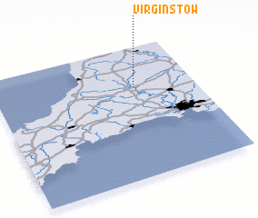 Places with similar names to Virginstow, United Kingdom ::
// Virginia City (US)
// Virginia City (US)
// Virginia City (US)
// Virginia City (US)
// Virgencita (DO)
Disclaimer :: Information on this page comes without warranty of any kind |
||
|
Where is Virginstow? Elevation and coordinates ::
Latitude (lat): 50°43'0"N Longitude (lon): 4°17'0"W
Elevation (approx.): 194m (map arrows pan, magnifying glasses zoom) |
||
|
Visiting Virginstow? Hotel/Accommodation ::
Book a hotel in Virginstow Travel Guide ::
rental cars ::
car rental offers GPS waypoint ::
download a GPX waypoint (PoI) of Virginstow for your GPS receiver
|
||