|
search place name
|
||
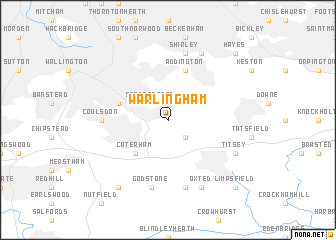
Warlingham (United Kingdom)Warlingham is a town in United Kingdom. An overview map of the region around Warlingham is displayed below.
regional and 3d topo map of Warlingham, United Kingdom ::
Warlingham airports ::
The nearest airport is BQH - Biggin Hill, located 6.7 km north east of Warlingham.
Other airports nearby include LGW - London Gatwick (19.5 km south west), LCY - London City (24.0 km north), LHR - London Heathrow (34.8 km north west), NHT - Northolt (38.1 km north west), Nearby towns ::
Woldingham (2.2km south east) //
Sanderstead (2.2km north west) //
Farleigh (2.2km north east) //
Whyteleafe (3.0km north west) //
Chelsham (3.0km north east) //
Caterham (4.4km south west) //
Kenley (3.9km north west) //
Purley (3.9km north west) //
Addington (5.7km north) //
Coulsdon (4.6km west) //
Godstone (7.5km south) //
Tandridge (7.5km south) //
Shirley (7.5km north) //
Titsey (5.9km south east) //
Oxted (7.8km south) //
West Wickham (7.8km north) //
Bletchingley (8.2km south west) //
Limpsfield (8.7km south east) //
Hayes (8.7km north east) //
[all distances 'as the bird flies' and approximate]  Places with similar names to Warlingham, United Kingdom ::
// Worlingham (GB)
Disclaimer :: Information on this page comes without warranty of any kind |
||
|
Where is Warlingham? Elevation and coordinates ::
Latitude (lat): 51°18'0"N Longitude (lon): 0°3'0"W
Elevation (approx.): 125m (map arrows pan, magnifying glasses zoom) |
||
|
Visiting Warlingham? Hotel/Accommodation ::
Book a hotel in Warlingham Travel Guide ::
rental cars ::
car rental offers GPS waypoint ::
download a GPX waypoint (PoI) of Warlingham for your GPS receiver
|
||