|
search place name
|
||
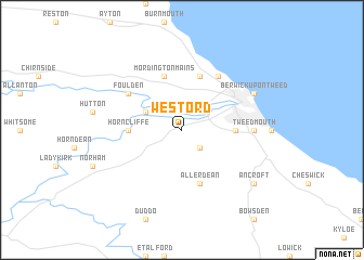
West Ord (United Kingdom)West Ord is a town in United Kingdom. An overview map of the region around West Ord is displayed below.
regional and 3d topo map of West Ord, United Kingdom ::
West Ord airports ::
The nearest airport is NCL - Newcastle, located 82.8 km south of West Ord.
Other airports nearby include EDI - Edinburgh (84.8 km west), ADX - Leuchars (85.5 km north west), DND - Dundee (98.4 km north west), CAX - Carlisle (102.0 km south west), Nearby towns ::
Middle Ord (2.1km south east) //
Paxton (2.8km north west) //
East Ord (3.1km east) //
Horncliffe (3.1km west) //
Mordington Mains (5.7km north) //
Lamberton (5.7km north) //
Allerdean (5.7km south) //
Foulden (4.8km north west) //
Marshall Meadows (5.9km north) //
Tweedmouth (4.2km east) //
Berwick-Upon-Tweed (5.6km north east) //
Ancroft (7.0km south east) //
[all distances 'as the bird flies' and approximate] 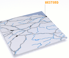 Places with similar names to West Ord, United Kingdom ::
// Westried (DE)
// Westerode (DE)
// Westerode (DE)
// Westerode (DE)
// Westerode (DE)
// Westerried (DE)
// Westarado (US)
// Westerrade (DE)
// Weistraat (BE)
// Westrode (BE)
Disclaimer :: Information on this page comes without warranty of any kind |
||
|
Where is West Ord? Elevation and coordinates ::
Latitude (lat): 55°45'0"N Longitude (lon): 2°4'0"W
Elevation (approx.): 42m (map arrows pan, magnifying glasses zoom) |
||
|
Visiting West Ord? Hotel/Accommodation ::
Book a hotel in West Ord Travel Guide ::
rental cars ::
car rental offers GPS waypoint ::
download a GPX waypoint (PoI) of West Ord for your GPS receiver
|
||