|
search place name
|
||
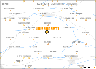
Whissonsett (United Kingdom)Whissonsett is a town in United Kingdom. An overview map of the region around Whissonsett is displayed below.
regional and 3d topo map of Whissonsett, United Kingdom ::
Whissonsett airports ::
The nearest airport is KNF - Marham, located 24.1 km south west of Whissonsett.
Other airports nearby include NWI - Norwich (30.9 km east), BEQ - Honington (47.5 km south), MHZ - Mildenhall (51.3 km south west), QCY - Coningsby (77.4 km north west), Nearby towns ::
Colkirk (3.7km north) //
Mileham (3.7km south) //
Brisley (2.9km south east) //
East Raynham (3.8km north west) //
South Raynham (3.8km north west) //
Tittleshall (3.8km south west) //
Fakenham (7.5km north) //
West Raynham (4.9km west) //
Gateley (4.9km east) //
Longham (7.5km south) //
Litcham (6.5km south west) //
Beeston (7.7km south) //
Little Ryburgh (7.1km north east) //
Great Ryburgh (7.1km north east) //
Beetley (7.1km south east) //
[all distances 'as the bird flies' and approximate]  Places with similar names to Whissonsett, United Kingdom ::
Disclaimer :: Information on this page comes without warranty of any kind |
||
|
Where is Whissonsett? Elevation and coordinates ::
Latitude (lat): 52°46'0"N Longitude (lon): 0°51'0"W
Elevation (approx.): 68m (map arrows pan, magnifying glasses zoom) |
||
|
Visiting Whissonsett? Hotel/Accommodation ::
Book a hotel in Whissonsett Travel Guide ::
rental cars ::
car rental offers GPS waypoint ::
download a GPX waypoint (PoI) of Whissonsett for your GPS receiver
|
||