|
search place name
|
||
Athenry (Gaillimh, Ireland)Athenry is a town in the Gaillimh region of Ireland. An overview map of the region around Athenry is displayed below.
regional and 3d topo map of Athenry, Ireland ::

Athenry airports ::
The nearest airport is GWY - Galway, located 13.2 km west of Athenry.
Other airports nearby include SNN - Shannon (67.3 km south), NOC - Connaught (68.5 km north), SXL - Sligo (109.9 km north), KIR - Kerry (134.9 km south west), Nearby towns ::
Baile Átha an Rí (0.0km north) //
Kingsland (1.5km east) //
River Village (2.8km north east) //
Montpelier (4.2km north east) //
Greethill (4.2km south west) //
Ballywinna (6.2km south) //
Esker (4.4km south east) //
Ballyboggan (4.6km north east) //
Ballymore (7.7km south) //
Creachmhaoil (7.8km south) //
Craughwell (7.8km south) //
Cahefurvan (7.4km south) //
Shanbally (8.1km south) //
Caherkinmonwee (7.6km south) //
Newcastle (6.6km north east) //
Caherbulligin (7.1km south west) //
Ballybackagh (6.3km north west) //
Coldwood (6.6km south west) //
Newtown (6.0km north west) //
Laragh Beg (9.0km north) //
Carrigeen (9.0km south) //
Monivea (8.5km north) //
Muine Mheá (8.5km north) //
Killeeneenmore (9.0km south west) //
Ballygarriff (8.3km south west) //
[all distances 'as the bird flies' and approximate] 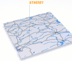 Places with similar names to Athenry, Ireland ::
// Athenree (NZ)
Disclaimer :: Information on this page comes without warranty of any kind |
||
|
Where is Athenry? Elevation and coordinates ::
Latitude (lat): 53°17'47"N Longitude (lon): 8°44'35"W
Elevation (approx.): 33m (map arrows pan, magnifying glasses zoom) |
||
|
Visiting Athenry? Hotel/Accommodation ::
Book a hotel in Athenry Travel Guide ::
Buy a travel guide for Ireland rental cars ::
car rental offers GPS waypoint ::
download a GPX waypoint (PoI) of Athenry for your GPS receiver
|
||