|
search place name
|
||
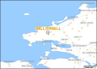
Ballinphull (Sligeach, Ireland)Ballinphull is a town in the Sligeach region of Ireland. An overview map of the region around Ballinphull is displayed below.
regional and 3d topo map of Ballinphull, Ireland ::
Ballinphull airports ::
The nearest airport is SXL - Sligo, located 9.6 km south of Ballinphull.
Other airports nearby include NOC - Connaught (53.0 km south), ENK - Enniskillen St Angelo (60.8 km east), LDY - Londonderry Eglinton (118.7 km north east), GWY - Galway (121.0 km south), Nearby towns ::
Breaghwy (1.3km north east) //
Doonowney (1.1km east) //
Cloghboley (2.3km south west) //
Lislary (2.8km north west) //
Saint Johns Port (3.8km south) //
Cloonagh (3.0km west) //
Mullaghnaneane (3.6km east) //
Rosses Point (6.5km south) //
An Ros (6.5km south) //
Cashelgarran (4.0km east) //
Carney (4.7km south east) //
Ballybeg (6.1km south east) //
Ballyconnell (4.3km west) //
Raghly (5.5km south west) //
An Ghráinseach (5.8km north east) //
Grange (5.8km north east) //
Moneygold (6.6km north east) //
Cregg (8.4km south east) //
[all distances 'as the bird flies' and approximate]  Places with similar names to Ballinphull, Ireland ::
// Belin Vale (RO)
// Bullionville (US)
// Blaineville (US)
// Bouillonville (FR)
// Bullainville (FR)
// Baillonville (BE)
// Baile an Phoill (IE)
// Ballinfoyle (IE)
// Ballinfulla (IE)
// Ballinphull (IE)
Disclaimer :: Information on this page comes without warranty of any kind |
||
|
Where is Ballinphull? Elevation and coordinates ::
Latitude (lat): 54°21'59"N Longitude (lon): 8°35'7"W
Elevation (approx.): 46m (map arrows pan, magnifying glasses zoom) |
||
|
Visiting Ballinphull? Hotel/Accommodation ::
Book a hotel in Ballinphull Travel Guide ::
Buy a travel guide for Ireland rental cars ::
car rental offers GPS waypoint ::
download a GPX waypoint (PoI) of Ballinphull for your GPS receiver
|
||