|
search place name
|
||
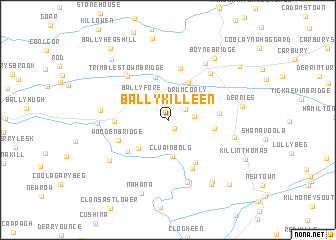
Ballykilleen (Offaly, Ireland)Ballykilleen is a town in the Offaly region of Ireland. An overview map of the region around Ballykilleen is displayed below.
regional and 3d topo map of Ballykilleen, Ireland ::
Ballykilleen airports ::
The nearest airport is DUB - Dublin, located 56.4 km east of Ballykilleen.
Other airports nearby include GWY - Galway (123.3 km west), WAT - Waterford (123.6 km south), ENK - Enniskillen St Angelo (128.0 km north), NOC - Connaught (133.1 km north west), Nearby towns ::
Kilcumber Bridge (0.9km south east) //
Shean (1.7km north east) //
Ballykilleen Cross Roads (2.3km north west) //
Shane Valley (1.8km east) //
Drumcooly (2.8km north east) //
Ballyfore (3.1km north west) //
Cluain Bolg (4.0km south) //
Clonbulloge (4.0km south) //
Cloncreen (3.7km south west) //
Killane (4.4km north) //
Cartland Bridge (4.9km north) //
Cushaling (3.2km east) //
Clonbrown (5.0km south) //
Cloncanon (4.0km north east) //
Clongarret (4.4km south west) //
Codd (3.5km east) //
Monasteroris (5.8km north) //
Clonroosk (5.6km south) //
Rathvilla (3.6km west) //
Woodenbridge (4.0km south west) //
Trimblestown Bridge (5.6km north west) //
Ballybrittan (5.8km north west) //
Edenderry (6.0km north east) //
Éaden Doire (6.0km north east) //
Derrygarran Bridge (7.0km south) //
Jonestown Cross Roads (6.8km north) //
Cushaling Bridge (4.8km south east) //
Rathlumber (4.7km west) //
Esker Bridge (4.8km west) //
[all distances 'as the bird flies' and approximate] 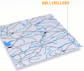 Places with similar names to Ballykilleen, Ireland ::
// Balogalon (PH)
// Balıkalan (TR)
// Bolia Kalān (IN)
// Blacklion (IE)
// Ballycallan (IE)
// Ballycollin (IE)
// Ballycollin (IE)
// Ballycoolan (IE)
// Ballycullane (IE)
// Ballycullane (IE)
Disclaimer :: Information on this page comes without warranty of any kind |
||
|
Where is Ballykilleen? Elevation and coordinates ::
Latitude (lat): 53°17'52"N Longitude (lon): 7°5'32"W
Elevation (approx.): 70m (map arrows pan, magnifying glasses zoom) |
||
|
Visiting Ballykilleen? Hotel/Accommodation ::
Book a hotel in Ballykilleen Travel Guide ::
Buy a travel guide for Ireland rental cars ::
car rental offers GPS waypoint ::
download a GPX waypoint (PoI) of Ballykilleen for your GPS receiver
|
||