|
search place name
|
||
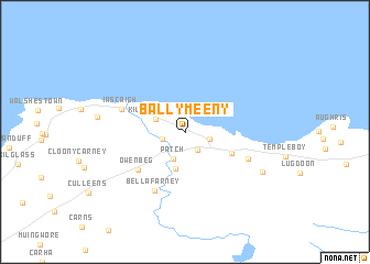
Ballymeeny (Sligeach, Ireland)Ballymeeny is a town in the Sligeach region of Ireland. An overview map of the region around Ballymeeny is displayed below.
regional and 3d topo map of Ballymeeny, Ireland ::
Ballymeeny airports ::
The nearest airport is SXL - Sligo, located 19.9 km east of Ballymeeny.
Other airports nearby include NOC - Connaught (40.2 km south), ENK - Enniskillen St Angelo (82.7 km east), GWY - Galway (107.8 km south), LDY - Londonderry Eglinton (141.7 km north east), Nearby towns ::
Dromore West (1.9km south) //
Clooneen (1.6km south west) //
Carrowmably (1.6km south east) //
Patch (2.8km south) //
Killeenduff (2.2km north west) //
Cannaghanally (3.7km south) //
Charlesfort (3.4km south east) //
Owenbeg (4.7km south west) //
Bellafarney (6.2km south) //
Altans (4.5km south east) //
Iascaigh (4.4km north west) //
Easky (4.4km north west) //
Doonbeakin (6.1km south east) //
[all distances 'as the bird flies' and approximate] 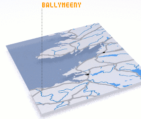 Places with similar names to Ballymeeny, Ireland ::
Disclaimer :: Information on this page comes without warranty of any kind |
||
|
Where is Ballymeeny? Elevation and coordinates ::
Latitude (lat): 54°16'5"N Longitude (lon): 8°54'13"W
Elevation (approx.): 45m (map arrows pan, magnifying glasses zoom) |
||
|
Visiting Ballymeeny? Hotel/Accommodation ::
Book a hotel in Ballymeeny Travel Guide ::
Buy a travel guide for Ireland rental cars ::
car rental offers GPS waypoint ::
download a GPX waypoint (PoI) of Ballymeeny for your GPS receiver
|
||