|
search place name
|
||
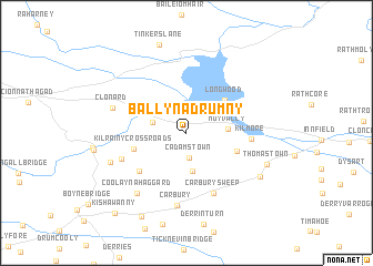
Ballynadrumny (Cill Dara, Ireland)Ballynadrumny is a town in the Cill Dara region of Ireland. An overview map of the region around Ballynadrumny is displayed below.
regional and 3d topo map of Ballynadrumny, Ireland ::
Ballynadrumny airports ::
The nearest airport is DUB - Dublin, located 45.7 km east of Ballynadrumny.
Other airports nearby include ENK - Enniskillen St Angelo (117.6 km north west), GWY - Galway (132.8 km west), NOC - Connaught (134.4 km north west), WAT - Waterford (138.0 km south), Nearby towns ::
Cadamstown (2.5km south) //
Bunglass (2.3km north west) //
Calfstown (3.9km south) //
Moyvally (2.6km east) //
Longwood (4.0km north east) //
Goreʼs Cross Roads (3.5km south east) //
Kilrainy Cross Roads (3.6km south west) //
Duftyʼs Cross Roads (4.7km south west) //
Kilmore (3.9km east) //
Carbury Sweep (6.3km south) //
Clogharinka (4.7km south west) //
Carbury (7.4km south) //
Clonard (5.1km north west) //
Coolayna Haggard (6.8km south west) //
Killinagh (5.4km south west) //
Kilshanchoe (6.2km south east) //
Thomastown (5.8km south east) //
Clonkeen Cross Roads (8.9km south) //
Kishawanny (9.2km south west) //
[all distances 'as the bird flies' and approximate] 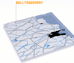 Places with similar names to Ballynadrumny, Ireland :: Disclaimer :: Information on this page comes without warranty of any kind |
||
|
Where is Ballynadrumny? Elevation and coordinates ::
Latitude (lat): 53°25'29"N Longitude (lon): 6°57'25"W
Elevation (approx.): 73m (map arrows pan, magnifying glasses zoom) |
||
|
Visiting Ballynadrumny? Hotel/Accommodation ::
Book a hotel in Ballynadrumny Travel Guide ::
Buy a travel guide for Ireland rental cars ::
car rental offers GPS waypoint ::
download a GPX waypoint (PoI) of Ballynadrumny for your GPS receiver
|
||