|
search place name
|
||
Ballynageragh (Corcaigh, Ireland)Ballynageragh is a town in the Corcaigh region of Ireland. An overview map of the region around Ballynageragh is displayed below.
regional and 3d topo map of Ballynageragh, Ireland ::

Ballynageragh airports ::
The nearest airport is SNN - Shannon, located 48.6 km north of Ballynageragh.
Other airports nearby include ORK - Cork (51.7 km south), KIR - Kerry (56.5 km west), WAT - Waterford (111.7 km east), GWY - Galway (114.0 km north), Nearby towns ::
Ballindillanig (1.0km south) //
Rath (1.6km south west) //
Churchtown (2.4km south west) //
Baile an Teampail (2.4km south west) //
Ballynatrideen (3.0km north) //
Ballynoran (3.7km north) //
Bregage Cross Roads (4.7km south) //
Milltown Cross Roads (5.4km north) //
Killare (6.2km north) //
Newtown (4.7km north east) //
Boolard (5.6km north west) //
Ballyhoura (4.7km east) //
Spital (5.6km south east) //
Buttevant (6.6km south east) //
Cill na Mallach (6.6km south east) //
Ráth Luirc (7.6km north) //
Castle Wrixon (5.2km east) //
Grange (8.3km south) //
Rathmorgan (7.4km north east) //
Newtownshandrum (8.1km north west) //
Baile Nua Sheandroma (8.1km north west) //
[all distances 'as the bird flies' and approximate] 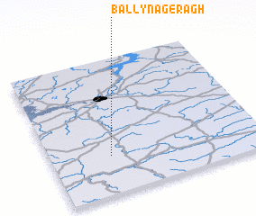 Places with similar names to Ballynageragh, Ireland ::
// Ballinageeragh (IE)
Disclaimer :: Information on this page comes without warranty of any kind |
||
|
Where is Ballynageragh? Elevation and coordinates ::
Latitude (lat): 52°17'5"N Longitude (lon): 8°42'54"W
Elevation (approx.): 96m (map arrows pan, magnifying glasses zoom) |
||
|
Visiting Ballynageragh? Hotel/Accommodation ::
Book a hotel in Ballynageragh Travel Guide ::
Buy a travel guide for Ireland rental cars ::
car rental offers GPS waypoint ::
download a GPX waypoint (PoI) of Ballynageragh for your GPS receiver
|
||