|
search place name
|
||
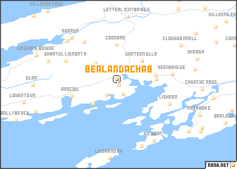
Béal an dá Chab (Corcaigh, Ireland)Béal an dá Chab is a town in the Corcaigh region of Ireland. An overview map of the region around Béal an dá Chab is displayed below.
regional and 3d topo map of Béal an dá Chab, Ireland ::
Béal an dá Chab airports ::
The nearest airport is KIR - Kerry, located 70.3 km north of Béal an dá Chab.
Other airports nearby include ORK - Cork (74.8 km north east), SNN - Shannon (133.4 km north), GWY - Galway (198.0 km north), Nearby towns ::
Ballydehob (0.0km north) //
Cappaghglass (1.5km south) //
Rossbrin (2.0km south west) //
Rathrnane Bridge (2.7km north) //
Derreennatra (3.9km south west) //
Rathruane (4.1km north west) //
Gurteenulla (4.4km north east) //
Letter (3.8km north west) //
Sealaclare Bridge (3.8km east) //
Crooked Bridge (4.0km north east) //
Coosane (6.3km north) //
Skull (5.0km west) //
An Scoil (5.0km west) //
Coolcoulagata (7.5km north west) //
Lisheen (5.9km south east) //
Meen Bridge (5.5km east) //
Shantullig North (6.4km north west) //
Durrus (8.7km north west) //
Dúras (8.7km north west) //
Kilmoon (9.6km south) //
Blairs Cove (8.6km north west) //
[all distances 'as the bird flies' and approximate] 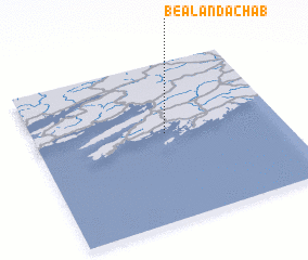 Places with similar names to Béal an dá Chab, Ireland :: Disclaimer :: Information on this page comes without warranty of any kind |
||
|
Where is Béal an dá Chab? Elevation and coordinates ::
Latitude (lat): 51°33'0"N Longitude (lon): 9°28'0"W
Elevation (approx.): 24m (map arrows pan, magnifying glasses zoom) |
||
|
Visiting Béal an dá Chab? Hotel/Accommodation ::
Book a hotel in Béal an dá Chab Travel Guide ::
Buy a travel guide for Ireland rental cars ::
car rental offers GPS waypoint ::
download a GPX waypoint (PoI) of Béal an dá Chab for your GPS receiver
|
||