|
search place name
|
||
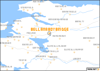
Bellanaboy Bridge (Maigh Eo, Ireland)Bellanaboy Bridge is a town in the Maigh Eo region of Ireland. An overview map of the region around Bellanaboy Bridge is displayed below.
regional and 3d topo map of Bellanaboy Bridge, Ireland ::
Bellanaboy Bridge airports ::
The nearest airport is NOC - Connaught, located 70.5 km south east of Bellanaboy Bridge.
Other airports nearby include SXL - Sligo (75.5 km east), GWY - Galway (116.0 km south east), SNN - Shannon (178.2 km south), Nearby towns ::
Muingingaun (2.3km south east) //
Muingerroon Bridge (3.2km west) //
Glencullin Lower (5.1km south) //
Annie Brady Bridge (5.5km north) //
Glenamoy (3.8km north east) //
Pollatomish (5.1km north west) //
Faulagh (4.0km west) //
Cloontakilla (7.0km south) //
Carnhill (5.6km north west) //
Rosdoagh (6.2km north west) //
Gortmore (6.1km south west) //
Knocknalower (4.5km north west) //
Derreens (4.9km south west) //
Attavally (7.8km south) //
Ross Port (7.0km north west) //
Carrowmore (5.0km west) //
Curraunboy (8.7km north) //
Ederglen (6.5km south west) //
Srahmore (9.0km south) //
Srahataggle South (8.0km south west) //
Sranataggle (9.1km north east) //
[all distances 'as the bird flies' and approximate] 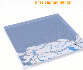 Places with similar names to Bellanaboy Bridge, Ireland :: Disclaimer :: Information on this page comes without warranty of any kind |
||
|
Where is Bellanaboy Bridge? Elevation and coordinates ::
Latitude (lat): 54°13'28"N Longitude (lon): 9°45'13"W
Elevation (approx.): 13m (map arrows pan, magnifying glasses zoom) |
||
|
Visiting Bellanaboy Bridge? Hotel/Accommodation ::
Book a hotel in Bellanaboy Bridge Travel Guide ::
Buy a travel guide for Ireland rental cars ::
car rental offers GPS waypoint ::
download a GPX waypoint (PoI) of Bellanaboy Bridge for your GPS receiver
|
||