|
search place name
|
||
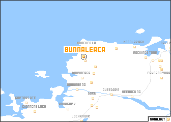
Bun na Leaca (Donegal, Ireland)Bun na Leaca is a town in the Donegal region of Ireland. An overview map of the region around Bun na Leaca is displayed below.
regional and 3d topo map of Bun na Leaca, Ireland ::
Bun na Leaca airports ::
The nearest airport is LDY - Londonderry Eglinton, located 72.1 km east of Bun na Leaca.
Other airports nearby include ENK - Enniskillen St Angelo (89.7 km south east), SXL - Sligo (95.3 km south), NOC - Connaught (138.7 km south), TRE - Tiree (177.6 km north east), Nearby towns ::
Brinlack (0.0km north) //
Corveen (1.8km south east) //
Knockfola (2.8km north) //
Stranabrooey (2.9km south) //
Doirí Beaga (3.7km south) //
Derrybeg (3.7km south) //
Middletown (4.8km south) //
An Bun Beag (6.4km south) //
Bunbeg (6.4km south) //
Meenaclady (4.7km north east) //
Dore (8.2km south) //
Gweedore (8.1km south east) //
Gaoth Dobhair (8.1km south east) //
[all distances 'as the bird flies' and approximate] 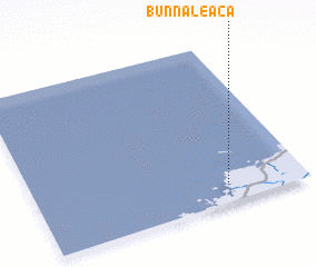 Places with similar names to Bun na Leaca, Ireland ::
Disclaimer :: Information on this page comes without warranty of any kind |
||
|
Where is Bun na Leaca? Elevation and coordinates ::
Latitude (lat): 55°7'0"N Longitude (lon): 8°17'0"W
Elevation (approx.): 44m (map arrows pan, magnifying glasses zoom) |
||
|
Visiting Bun na Leaca? Hotel/Accommodation ::
Book a hotel in Bun na Leaca Travel Guide ::
Buy a travel guide for Ireland rental cars ::
car rental offers GPS waypoint ::
download a GPX waypoint (PoI) of Bun na Leaca for your GPS receiver
|
||