|
search place name
|
||
Carrickmacross (Monaghan, Ireland)Carrickmacross is a town in the Monaghan region of Ireland. An overview map of the region around Carrickmacross is displayed below.
regional and 3d topo map of Carrickmacross, Ireland ::

Carrickmacross airports ::
The nearest airport is DUB - Dublin, located 68.2 km south east of Carrickmacross.
Other airports nearby include ENK - Enniskillen St Angelo (77.2 km north west), BFS - Belfast Aldergrove (83.0 km north east), BHD - Belfast City (90.5 km north east), LDY - Londonderry Eglinton (122.5 km north), Nearby towns ::
Carraig Mhachaire Rois (0.0km north) //
Aghlattacru (3.2km south) //
Donaghmoyne (3.3km north) //
Lisgall (3.8km north) //
Tiragarvan (3.3km west) //
Cashlan (5.1km north) //
Tullyvaragh Lower (5.8km north) //
Monalia (6.2km north) //
Ballymackney (4.0km south east) //
Tullylougherny (4.5km south west) //
Lisdoonan (6.3km north) //
Carrickmaclim (4.2km west) //
Rahans (4.7km north east) //
Feegavla (5.7km north east) //
Magheracloone (5.8km south west) //
Drummanreagh (8.3km north) //
The Cross Guns (8.2km south) //
Ardagh (8.5km south) //
Ballybay Cross Roads (6.8km north west) //
Kiltybegs (5.7km north east) //
Carrickartagh (6.0km north west) //
Laragh (8.8km north west) //
Cargaghlisnanarney (7.9km north east) //
Culloville (9.5km north) //
[all distances 'as the bird flies' and approximate] 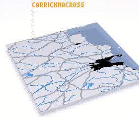 Places with similar names to Carrickmacross, Ireland :: Disclaimer :: Information on this page comes without warranty of any kind |
||
|
Where is Carrickmacross? Elevation and coordinates ::
Latitude (lat): 53°58'22"N Longitude (lon): 6°43'8"W
Elevation (approx.): 40m (map arrows pan, magnifying glasses zoom) |
||
|
Visiting Carrickmacross? Hotel/Accommodation ::
Book a hotel in Carrickmacross Travel Guide ::
Buy a travel guide for Ireland rental cars ::
car rental offers GPS waypoint ::
download a GPX waypoint (PoI) of Carrickmacross for your GPS receiver
|
||