|
search place name
|
||
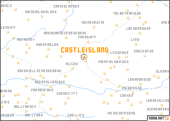
Castleisland (Ciarraí, Ireland)Castleisland is a town in the Ciarraí region of Ireland. An overview map of the region around Castleisland is displayed below.
regional and 3d topo map of Castleisland, Ireland ::
Castleisland airports ::
The nearest airport is KIR - Kerry, located 7.0 km south west of Castleisland.
Other airports nearby include SNN - Shannon (63.8 km north east), ORK - Cork (79.9 km south east), GWY - Galway (123.9 km north), NOC - Connaught (191.6 km north), Nearby towns ::
Oileán Ciarraí (0.0km north) //
Cloonagh Bridge (0.9km north) //
Kilcow (2.4km south west) //
Fahaduff (4.2km north) //
Fieries (3.8km south east) //
Knockeen Cross Roads (3.4km west) //
Cliddaun (4.3km south west) //
Coolnageragh (5.1km south east) //
Ballynahallia (3.8km south east) //
Gortglass (5.0km south east) //
Fairfield Bridge (4.0km east) //
Broughane Cross Roads (5.7km north west) //
Flesk Bridge (6.1km south) //
Kilcusnaun (4.6km east) //
Muingvautia (7.5km north) //
Mweennalaa (5.6km north west) //
Woodville (5.3km west) //
Curracitty (8.6km south) //
Scartaglin (7.2km south east) //
OʼConnell Bridge (7.3km south west) //
Canguillia (8.3km south east) //
Twiss Bridge (7.9km south east) //
Ballyduff (9.0km north east) //
[all distances 'as the bird flies' and approximate] 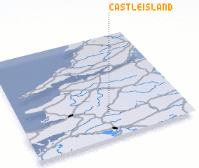 Places with similar names to Castleisland, Ireland :: Disclaimer :: Information on this page comes without warranty of any kind |
||
|
Where is Castleisland? Elevation and coordinates ::
Latitude (lat): 52°14'0"N Longitude (lon): 9°28'0"W
Elevation (approx.): 29m (map arrows pan, magnifying glasses zoom) |
||
|
Visiting Castleisland? Hotel/Accommodation ::
Book a hotel in Castleisland Travel Guide ::
Buy a travel guide for Ireland rental cars ::
car rental offers GPS waypoint ::
download a GPX waypoint (PoI) of Castleisland for your GPS receiver
|
||