|
search place name
|
||
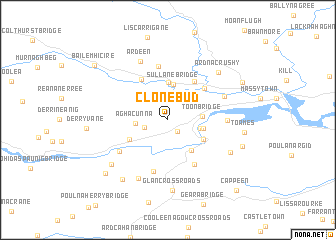
Clonebud (Corcaigh, Ireland)Clonebud is a town in the Corcaigh region of Ireland. An overview map of the region around Clonebud is displayed below.
regional and 3d topo map of Clonebud, Ireland ::
Clonebud airports ::
The nearest airport is ORK - Cork, located 39.4 km east of Clonebud.
Other airports nearby include KIR - Kerry (46.4 km north west), SNN - Shannon (92.1 km north), WAT - Waterford (139.7 km east), GWY - Galway (158.4 km north), Nearby towns ::
Kilbarry (1.5km south east) //
Rassmore (1.8km south west) //
Aghacunna (2.3km west) //
Boylegrove (2.4km south east) //
Toon Bridge (2.4km east) //
Sullane Bridge (3.9km north) //
Inchisine (2.6km east) //
Lissacresig (4.2km north) //
Kilmichael (3.7km south east) //
Dromcarra Bridge (3.3km south east) //
Gortaveer (3.4km south west) //
Garrane (4.6km north east) //
Coolavokig (4.9km north) //
Carrigaphooea Bridge (4.4km north east) //
Dromleigh (5.3km south) //
Killhanna Cross Roads (5.8km south) //
Scronagare (6.0km north) //
Bohaneʼs Cross Roads (4.9km south west) //
Annahatn (4.1km east) //
Linnamilla Bridge (4.7km north east) //
Ardeen (6.8km north) //
Johnstown (6.9km south) //
Ardnacrushy (6.4km north east) //
Deshure (5.6km south east) //
Glan Cross Roads (7.9km south) //
Inse Geimhleach (6.4km south west) //
Inchigeelagh (6.4km south west) //
Carrigdangan (7.3km south west) //
Toames (5.4km east) //
[all distances 'as the bird flies' and approximate]  Places with similar names to Clonebud, Ireland ::
Disclaimer :: Information on this page comes without warranty of any kind |
||
|
Where is Clonebud? Elevation and coordinates ::
Latitude (lat): 51°52'42"N Longitude (lon): 9°3'34"W
Elevation (approx.): 105m (map arrows pan, magnifying glasses zoom) |
||
|
Visiting Clonebud? Hotel/Accommodation ::
Book a hotel in Clonebud Travel Guide ::
Buy a travel guide for Ireland rental cars ::
car rental offers GPS waypoint ::
download a GPX waypoint (PoI) of Clonebud for your GPS receiver
|
||