|
search place name
|
||
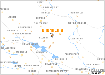
Drumacrib (Monaghan, Ireland)Drumacrib is a town in the Monaghan region of Ireland. An overview map of the region around Drumacrib is displayed below.
regional and 3d topo map of Drumacrib, Ireland ::
Drumacrib airports ::
The nearest airport is BFS - Belfast Aldergrove, located 63.8 km north east of Drumacrib.
Other airports nearby include ENK - Enniskillen St Angelo (70.2 km north west), BHD - Belfast City (73.4 km north east), DUB - Dublin (84.8 km south), LDY - Londonderry Eglinton (104.8 km north), Nearby towns ::
Tullychattina (1.8km south) //
Lurganearly (2.0km north east) //
Drumakill (3.1km south) //
Mill Town (2.2km south west) //
Dromore (3.7km south) //
Altnamackan (2.9km north east) //
Tullynageer (4.6km north west) //
Carnagh (6.4km north) //
Annalittin (6.8km south) //
Darkley (7.9km north) //
Creaghanroe (5.1km north west) //
Castleblayney (5.7km south west) //
Baile na Lorgan (5.7km south west) //
Tullanacrunat (8.4km south) //
Thornford (8.0km south) //
Cullyhanna (5.4km east) //
Tullyvin (6.5km south west) //
Newtownhamilton (6.6km north east) //
Crossmaglen (8.2km south east) //
Dungormley (9.3km north east) //
[all distances 'as the bird flies' and approximate] 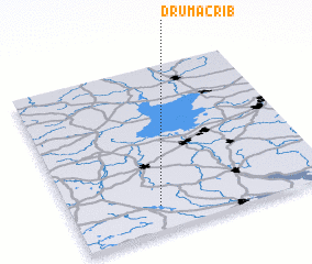 Places with similar names to Drumacrib, Ireland ::
// Douar Meguerba (TN)
Disclaimer :: Information on this page comes without warranty of any kind |
||
|
Where is Drumacrib? Elevation and coordinates ::
Latitude (lat): 54°8'49"N Longitude (lon): 6°39'48"W
Elevation (approx.): 168m (map arrows pan, magnifying glasses zoom) |
||
|
Visiting Drumacrib? Hotel/Accommodation ::
Book a hotel in Drumacrib Travel Guide ::
Buy a travel guide for Ireland rental cars ::
car rental offers GPS waypoint ::
download a GPX waypoint (PoI) of Drumacrib for your GPS receiver
|
||