|
search place name
|
||
Drumnafinnila (Ireland)Drumnafinnila is a town in Ireland. An overview map of the region around Drumnafinnila is displayed below.
regional and 3d topo map of Drumnafinnila, Ireland ::

Drumnafinnila airports ::
The nearest airport is ENK - Enniskillen St Angelo, located 35.8 km north east of Drumnafinnila.
Other airports nearby include SXL - Sligo (41.7 km west), NOC - Connaught (59.9 km south west), GWY - Galway (113.2 km south west), LDY - Londonderry Eglinton (113.2 km north east), Nearby towns ::
Ballinagleragh (0.8km north west) //
Drumristin (1.3km south) //
Kilgarriff (1.5km north west) //
Fahy (1.4km west) //
Greaghnafarna (2.5km north) //
Cornamucklagh South (3.1km south) //
Sruhanagh (4.5km north) //
Dowra (4.7km north) //
Greaghnaguillaun (5.1km south) //
Annagh Upper (4.7km north west) //
Coollegreane (6.0km north) //
Corry (4.6km north west) //
Slievenakilla (4.3km east) //
Tober (7.4km north) //
Corleckagh (6.6km north east) //
Shass (6.4km north west) //
Ross (6.9km north west) //
Lavaur (8.2km south) //
Tullynamoyle (8.4km north) //
Coppanaghmore (6.6km north east) //
Derrintober (8.8km south) //
Aughrim (8.4km north) //
Ummera (6.9km north west) //
Mullaghgarve (8.8km south east) //
[all distances 'as the bird flies' and approximate] 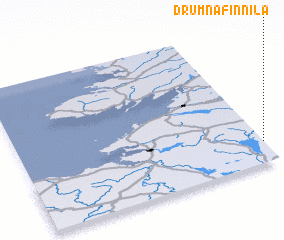 Places with similar names to Drumnafinnila, Ireland :: Disclaimer :: Information on this page comes without warranty of any kind |
||
|
Where is Drumnafinnila? Elevation and coordinates ::
Latitude (lat): 54°9'0"N Longitude (lon): 8°0'0"W
Elevation (approx.): 71m (map arrows pan, magnifying glasses zoom) |
||
|
Visiting Drumnafinnila? Hotel/Accommodation ::
Book a hotel in Drumnafinnila Travel Guide ::
Buy a travel guide for Ireland rental cars ::
car rental offers GPS waypoint ::
download a GPX waypoint (PoI) of Drumnafinnila for your GPS receiver
|
||