|
search place name
|
||
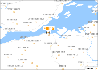
Faing (Limerick, Ireland)Faing is a town in the Limerick region of Ireland. An overview map of the region around Faing is displayed below.
regional and 3d topo map of Faing, Ireland ::
Faing airports ::
The nearest airport is SNN - Shannon, located 16.1 km north east of Faing.
Other airports nearby include KIR - Kerry (55.6 km south west), GWY - Galway (77.5 km north), ORK - Cork (95.6 km south east), NOC - Connaught (145.9 km north), Nearby towns ::
Foynes (0.0km north) //
Shanagolden (4.4km south) //
Seanghualainn (4.4km south) //
Bartholomews Bridge (4.5km south east) //
Knocknabooly (4.8km south west) //
Killadysert (6.7km north) //
Cill an Dísirt (6.7km north) //
Barrigone (4.3km east) //
Cappanavarnoge (5.9km north west) //
Saint Josephʼs (8.0km south) //
Effernan (6.1km north west) //
Kilcolman (9.0km south) //
Creeves (7.6km south east) //
[all distances 'as the bird flies' and approximate] 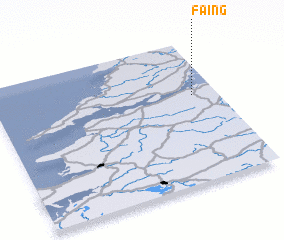 Places with similar names to Faing, Ireland ::
Disclaimer :: Information on this page comes without warranty of any kind |
||
|
Where is Faing? Elevation and coordinates ::
Latitude (lat): 52°36'41"N Longitude (lon): 9°6'37"W
Elevation (approx.): 13m (map arrows pan, magnifying glasses zoom) |
||
|
Visiting Faing? Hotel/Accommodation ::
Book a hotel in Faing Travel Guide ::
Buy a travel guide for Ireland rental cars ::
car rental offers GPS waypoint ::
download a GPX waypoint (PoI) of Faing for your GPS receiver
|
||