|
search place name
|
||
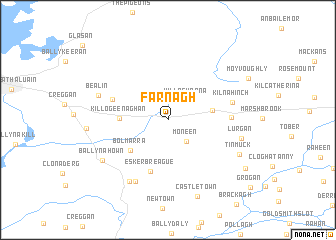
Farnagh (An Iarmhí, Ireland)Farnagh is a town in the An Iarmhí region of Ireland. An overview map of the region around Farnagh is displayed below.
regional and 3d topo map of Farnagh, Ireland ::
Farnagh airports ::
The nearest airport is GWY - Galway, located 78.0 km west of Farnagh.
Other airports nearby include NOC - Connaught (89.7 km north west), DUB - Dublin (100.5 km east), SNN - Shannon (108.5 km south west), ENK - Enniskillen St Angelo (112.4 km north), Nearby towns ::
Killachonna (2.5km north east) //
Moneen (2.7km south east) //
Ballynagarbry (3.2km east) //
Bolmarra (4.3km south west) //
Killogeenaghan (3.3km west) //
Eskerbreague (5.9km south) //
Tullymagawly (4.3km north west) //
Moate (4.2km east) //
An Móta (4.2km east) //
Kilnahinch (4.7km north east) //
Togher (7.2km south) //
Doon Cross Road (7.3km south) //
Bealin (5.4km north west) //
Lurgan (5.3km south east) //
Ballynahown (6.3km south west) //
Tinmuck (6.1km south east) //
Castletown (8.8km south) //
Moorock (7.5km south east) //
[all distances 'as the bird flies' and approximate] 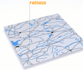 Places with similar names to Farnagh, Ireland ::
Disclaimer :: Information on this page comes without warranty of any kind |
||
|
Where is Farnagh? Elevation and coordinates ::
Latitude (lat): 53°23'30"N Longitude (lon): 7°46'50"W
Elevation (approx.): 77m (map arrows pan, magnifying glasses zoom) |
||
|
Visiting Farnagh? Hotel/Accommodation ::
Book a hotel in Farnagh Travel Guide ::
Buy a travel guide for Ireland rental cars ::
car rental offers GPS waypoint ::
download a GPX waypoint (PoI) of Farnagh for your GPS receiver
|
||