|
search place name
|
||
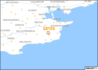
Gates (Port Láirge, Ireland)Gates is a town in the Port Láirge region of Ireland. An overview map of the region around Gates is displayed below.
regional and 3d topo map of Gates, Ireland ::
Gates airports ::
The nearest airport is WAT - Waterford, located 41.8 km north east of Gates.
Other airports nearby include ORK - Cork (62.5 km west), SNN - Shannon (117.6 km north west), KIR - Kerry (131.7 km west), GWY - Galway (169.3 km north west), Nearby towns ::
Loskeran (0.9km north) //
Glenard (1.8km south) //
Ballymacart Bridge (2.0km south west) //
Ballycurreen South (2.1km east) //
Faha (3.8km north) //
Gowlaun (2.9km west) //
Rathnameneenagh (3.5km north east) //
Robertʼs Cross Roads (5.0km north) //
Gorteen (4.4km north west) //
Calaiste (5.3km north) //
Ringville (5.2km north east) //
Killangford Bridge (6.5km north) //
Newtown (6.9km north) //
Ballynagaul (6.1km north east) //
Twomile Bridge (8.0km north west) //
Paulsworth (6.6km south west) //
Knocknahoola (7.1km north west) //
Kilmarry (9.1km north west) //
Ballycullane (8.2km north west) //
Ballynacourty (9.4km north east) //
[all distances 'as the bird flies' and approximate] 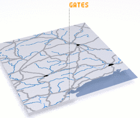 Places with similar names to Gates, Ireland ::
Disclaimer :: Information on this page comes without warranty of any kind |
||
|
Where is Gates? Elevation and coordinates ::
Latitude (lat): 52°0'27"N Longitude (lon): 7°37'24"W
Elevation (approx.): 104m (map arrows pan, magnifying glasses zoom) |
||
|
Visiting Gates? Hotel/Accommodation ::
Book a hotel in Gates Travel Guide ::
Buy a travel guide for Ireland rental cars ::
car rental offers GPS waypoint ::
download a GPX waypoint (PoI) of Gates for your GPS receiver
|
||