|
search place name
|
||
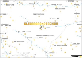
Gleann an Phréacháin (Corcaigh, Ireland)Gleann an Phréacháin is a town in the Corcaigh region of Ireland. An overview map of the region around Gleann an Phréacháin is displayed below.
regional and 3d topo map of Gleann an Phréacháin, Ireland ::
Gleann an Phréacháin airports ::
The nearest airport is ORK - Cork, located 23.0 km south of Gleann an Phréacháin.
Other airports nearby include KIR - Kerry (76.8 km west), SNN - Shannon (80.8 km north west), WAT - Waterford (93.0 km east), GWY - Galway (144.1 km north), Nearby towns ::
Glenville (0.0km north) //
Old Bride Bridge (1.5km north east) //
Kean Bridge (1.2km east) //
Scrahane Cross Roads (4.3km south) //
Powerʼs Bridge (5.7km north) //
Killeagh Cross Roads (5.3km south) //
Ballindeenisk Cross Roads (6.0km south) //
Glannagaul (5.4km north east) //
Ballyvorisheen (5.0km south west) //
Templemichael Bridge (8.3km south) //
Gortroche (8.5km north) //
Carrignavar (7.2km south west) //
Dunbulloge Bridge (8.1km south) //
Ballinvinny North (7.8km south east) //
Ballinlegane Cross Roads (7.6km south east) //
Coole West (9.2km south) //
Knockananig (9.8km north east) //
[all distances 'as the bird flies' and approximate] 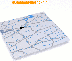 Places with similar names to Gleann an Phréacháin, Ireland :: Disclaimer :: Information on this page comes without warranty of any kind |
||
|
Where is Gleann an Phréacháin? Elevation and coordinates ::
Latitude (lat): 52°2'38"N Longitude (lon): 8°25'29"W
Elevation (approx.): 146m (map arrows pan, magnifying glasses zoom) |
||
|
Visiting Gleann an Phréacháin? Hotel/Accommodation ::
Book a hotel in Gleann an Phréacháin Travel Guide ::
Buy a travel guide for Ireland rental cars ::
car rental offers GPS waypoint ::
download a GPX waypoint (PoI) of Gleann an Phréacháin for your GPS receiver
|
||