|
search place name
|
||
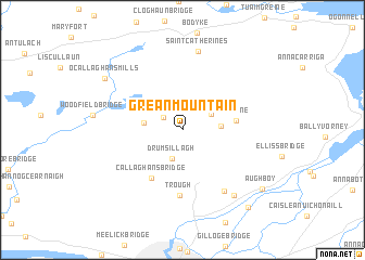
Grean Mountain (An Clár, Ireland)Grean Mountain is a town in the An Clár region of Ireland. An overview map of the region around Grean Mountain is displayed below.
regional and 3d topo map of Grean Mountain, Ireland ::
Grean Mountain airports ::
The nearest airport is SNN - Shannon, located 23.3 km south west of Grean Mountain.
Other airports nearby include GWY - Galway (60.5 km north), KIR - Kerry (92.0 km south west), ORK - Cork (106.3 km south), WAT - Waterford (123.8 km south east), Nearby towns ::
Broadford (1.7km north west) //
Áth Leathen (1.7km north west) //
Drumsillagh (3.0km south) //
Cloongaheen East (2.4km north east) //
Scottʼs Bridge (2.4km east) //
Kilseily (2.5km west) //
Kilbane (3.5km east) //
Callaghanʼs Bridge (5.3km south) //
Trough (6.7km south) //
Knockbrack Upper (6.9km south) //
Boherglass (8.2km north) //
Saint Catherines (8.2km north) //
Ballyvourcher (7.4km south east) //
OʼCallaghansmills (7.2km north west) //
Aughboy (7.8km south east) //
Cluain Lára (8.9km south east) //
Cloonlara (8.9km south east) //
[all distances 'as the bird flies' and approximate] 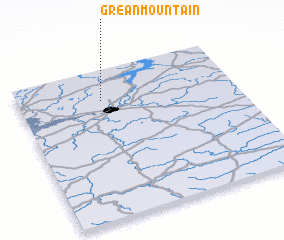 Places with similar names to Grean Mountain, Ireland ::
Disclaimer :: Information on this page comes without warranty of any kind |
||
|
Where is Grean Mountain? Elevation and coordinates ::
Latitude (lat): 52°47'37"N Longitude (lon): 8°36'52"W
Elevation (approx.): 97m (map arrows pan, magnifying glasses zoom) |
||
|
Visiting Grean Mountain? Hotel/Accommodation ::
Book a hotel in Grean Mountain Travel Guide ::
Buy a travel guide for Ireland rental cars ::
car rental offers GPS waypoint ::
download a GPX waypoint (PoI) of Grean Mountain for your GPS receiver
|
||