|
search place name
|
||
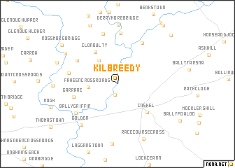
Kilbreedy (Tiobraid Árann, Ireland)Kilbreedy is a town in the Tiobraid Árann region of Ireland. An overview map of the region around Kilbreedy is displayed below.
regional and 3d topo map of Kilbreedy, Ireland ::
Kilbreedy airports ::
The nearest airport is SNN - Shannon, located 69.4 km west of Kilbreedy.
Other airports nearby include WAT - Waterford (70.5 km south east), ORK - Cork (88.4 km south west), GWY - Galway (107.2 km north west), KIR - Kerry (116.4 km west), Nearby towns ::
Camus Bridge (1.8km south) //
Faheen Cross Roads (2.9km west) //
Goolds Cross (4.2km north west) //
Clonoulty (5.5km north west) //
Caiseal (5.3km south east) //
Cashel (5.3km south east) //
Garrane (4.7km south west) //
Ballagh (5.4km north west) //
Twoford Bridges (6.9km north) //
Cappanarragh (5.0km west) //
Ballygriffin (6.1km south west) //
Rathkennan Bridge (8.1km north) //
Garranmore (8.1km north) //
An Gabhailín (7.4km south west) //
Golden (7.4km south west) //
Clone Bridge (7.0km north west) //
Racecourse Cross (9.2km south) //
Rossmore Bridge (8.2km north west) //
Galbertstown (9.3km north east) //
[all distances 'as the bird flies' and approximate]  Places with similar names to Kilbreedy, Ireland ::
Disclaimer :: Information on this page comes without warranty of any kind |
||
|
Where is Kilbreedy? Elevation and coordinates ::
Latitude (lat): 52°33'22"N Longitude (lon): 7°55'42"W
Elevation (approx.): 78m (map arrows pan, magnifying glasses zoom) |
||
|
Visiting Kilbreedy? Hotel/Accommodation ::
Book a hotel in Kilbreedy Travel Guide ::
Buy a travel guide for Ireland rental cars ::
car rental offers GPS waypoint ::
download a GPX waypoint (PoI) of Kilbreedy for your GPS receiver
|
||