|
search place name
|
||
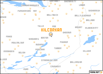
Kilcorkan (An Clár, Ireland)Kilcorkan is a town in the An Clár region of Ireland. An overview map of the region around Kilcorkan is displayed below.
regional and 3d topo map of Kilcorkan, Ireland ::
Kilcorkan airports ::
The nearest airport is GWY - Galway, located 28.5 km north of Kilcorkan.
Other airports nearby include SNN - Shannon (38.2 km south), NOC - Connaught (96.5 km north), KIR - Kerry (104.8 km south west), ORK - Cork (136.9 km south), Nearby towns ::
Boston (2.0km south west) //
Roo (2.8km north) //
Tirneevin (2.7km north east) //
Tulla (3.6km north west) //
Fiddaun (4.1km south east) //
Aughrim (4.6km south west) //
Tubber (5.4km south) //
Killinny (5.7km north) //
Sheeaun (3.5km east) //
Laghtyslaughnessy (3.7km east) //
Coolbaun (6.3km south) //
Killomoran (6.1km north) //
Skaghard (4.2km south west) //
Shanaglish (5.2km south east) //
Rinecaha (6.1km south west) //
Ballybuck (6.9km north) //
Derry (5.1km south east) //
Cahererillan (7.2km north) //
Cannahawna (5.2km east) //
Cappaghmore (7.4km north west) //
Gortskeagh (8.7km north west) //
Cahermore (9.0km north) //
Moy (9.1km north west) //
[all distances 'as the bird flies' and approximate] 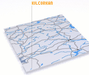 Places with similar names to Kilcorkan, Ireland ::
// Kalʼ-Kurgan (UZ)
// Kilcreggan (GB)
Disclaimer :: Information on this page comes without warranty of any kind |
||
|
Where is Kilcorkan? Elevation and coordinates ::
Latitude (lat): 53°2'43"N Longitude (lon): 8°54'28"W
Elevation (approx.): 25m (map arrows pan, magnifying glasses zoom) |
||
|
Visiting Kilcorkan? Hotel/Accommodation ::
Book a hotel in Kilcorkan Travel Guide ::
Buy a travel guide for Ireland rental cars ::
car rental offers GPS waypoint ::
download a GPX waypoint (PoI) of Kilcorkan for your GPS receiver
|
||