|
search place name
|
||
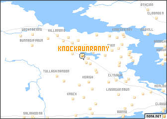
Knockaunranny (Gaillimh, Ireland)Knockaunranny is a town in the Gaillimh region of Ireland. An overview map of the region around Knockaunranny is displayed below.
regional and 3d topo map of Knockaunranny, Ireland ::
Knockaunranny airports ::
The nearest airport is GWY - Galway, located 20.6 km east of Knockaunranny.
Other airports nearby include NOC - Connaught (66.4 km north east), SNN - Shannon (76.7 km south), SXL - Sligo (109.9 km north), KIR - Kerry (133.4 km south), Nearby towns ::
Shanballyoghery (0.9km south east) //
Coolagh (0.7km north east) //
Newtown (1.3km south east) //
Killannin (2.1km north east) //
Doon (1.9km north west) //
Garrynagry (3.2km north) //
Drimmavohaun (2.9km south east) //
Moyascragh (2.8km north east) //
Moycullen (3.3km south east) //
Maigh Cuilinn (3.3km south east) //
Gortnandarragh (4.4km north) //
Gortnagroagh (4.0km north) //
Cloonnabinnia (3.1km east) //
Keaigh (5.1km south) //
Finisklin (5.8km south) //
Porridgetown (5.4km north west) //
Laghtgannon (5.0km north west) //
Corranellistrum (5.8km north) //
Knockatee (5.5km south west) //
Ower (4.3km north east) //
Laughil (6.7km south) //
Tullaghnanoon (5.2km south west) //
Killagoola (6.1km south east) //
Carrowmoreknock (6.3km north east) //
Killarone (6.4km north west) //
Leagaun (5.0km east) //
Ballynahallia (4.9km east) //
Gortmore (5.3km north east) //
Gortachalla (5.1km east) //
[all distances 'as the bird flies' and approximate]  Places with similar names to Knockaunranny, Ireland ::
// Nicanoreño (MX)
Disclaimer :: Information on this page comes without warranty of any kind |
||
|
Where is Knockaunranny? Elevation and coordinates ::
Latitude (lat): 53°21'58"N Longitude (lon): 9°13'49"W
Elevation (approx.): 47m (map arrows pan, magnifying glasses zoom) |
||
|
Visiting Knockaunranny? Hotel/Accommodation ::
Book a hotel in Knockaunranny Travel Guide ::
Buy a travel guide for Ireland rental cars ::
car rental offers GPS waypoint ::
download a GPX waypoint (PoI) of Knockaunranny for your GPS receiver
|
||