|
search place name
|
||
Larganreagh (Donegal, Ireland)Larganreagh is a town in the Donegal region of Ireland. An overview map of the region around Larganreagh is displayed below.
regional and 3d topo map of Larganreagh, Ireland ::

Larganreagh airports ::
The nearest airport is LDY - Londonderry Eglinton, located 46.1 km east of Larganreagh.
Other airports nearby include ENK - Enniskillen St Angelo (89.8 km south), ILY - Islay (113.2 km north east), SXL - Sligo (113.7 km south west), BFS - Belfast Aldergrove (119.8 km south east), Nearby towns ::
Rosapenna (1.4km south) //
Derrycassan (1.3km north west) //
Cloghbane (2.0km north east) //
Downies (1.4km west) //
Na Dúnaibh (1.4km west) //
Doagh (3.3km north west) //
Carraig Airt (3.4km south east) //
Carrickart (3.4km south east) //
Glenree (5.2km south) //
Glinsk (3.2km east) //
Glenkeo (5.0km south) //
Gortnalughoge (4.5km north east) //
Melmore (5.2km north east) //
Drum Irish (6.7km south) //
Creevagh (6.8km south) //
Rawros (4.4km south east) //
Gortnabrade (5.3km south east) //
Mullan (7.6km south) //
Glen (8.3km south) //
Marble Hill (5.4km south west) //
Leatbeg (5.4km east) //
Cashel (8.5km south) //
Tullagh (7.0km south east) //
[all distances 'as the bird flies' and approximate] 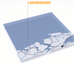 Places with similar names to Larganreagh, Ireland :: Disclaimer :: Information on this page comes without warranty of any kind |
||
|
Where is Larganreagh? Elevation and coordinates ::
Latitude (lat): 55°11'57"N Longitude (lon): 7°49'48"W
Elevation (approx.): 52m (map arrows pan, magnifying glasses zoom) |
||
|
Visiting Larganreagh? Hotel/Accommodation ::
Book a hotel in Larganreagh Travel Guide ::
Buy a travel guide for Ireland rental cars ::
car rental offers GPS waypoint ::
download a GPX waypoint (PoI) of Larganreagh for your GPS receiver
|
||