|
search place name
|
||
Lennaght (Monaghan, Ireland)Lennaght is a town in the Monaghan region of Ireland. An overview map of the region around Lennaght is displayed below.
regional and 3d topo map of Lennaght, Ireland ::

Lennaght airports ::
The nearest airport is ENK - Enniskillen St Angelo, located 34.2 km west of Lennaght.
Other airports nearby include BFS - Belfast Aldergrove (74.1 km north east), LDY - Londonderry Eglinton (84.4 km north), BHD - Belfast City (91.5 km north east), SXL - Sligo (93.6 km west), Nearby towns ::
Derrylea (2.3km south east) //
Sheskin (3.1km east) //
Selloo (4.3km south east) //
Allagesh (4.1km south east) //
Drumcoo (4.1km north east) //
Nart (5.7km south) //
Rosslea (5.9km south) //
The Rock (4.4km east) //
Bulloghbrean (7.8km south) //
Magherarny Cross Roads (8.4km south east) //
Cavan (8.7km south) //
Smithborough (8.3km south east) //
Killina (10.1km south east) //
[all distances 'as the bird flies' and approximate] 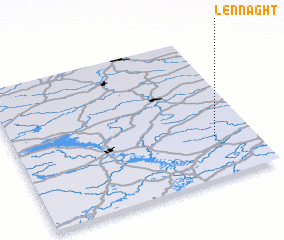 Places with similar names to Lennaght, Ireland ::
// Lanivato (MG)
// Lanivato (MG)
// Lanivato (MG)
// La Envidia (CO)
// La Envidia (CO)
// La Envidia (CO)
// La Envidia (CO)
// La Envidia (CO)
// La Envidia (CO)
// La Naveta (CO)
Disclaimer :: Information on this page comes without warranty of any kind |
||
|
Where is Lennaght? Elevation and coordinates ::
Latitude (lat): 54°17'6"N Longitude (lon): 7°9'46"W
Elevation (approx.): 123m (map arrows pan, magnifying glasses zoom) |
||
|
Visiting Lennaght? Hotel/Accommodation ::
Book a hotel in Lennaght Travel Guide ::
Buy a travel guide for Ireland rental cars ::
car rental offers GPS waypoint ::
download a GPX waypoint (PoI) of Lennaght for your GPS receiver
|
||