|
search place name
|
||
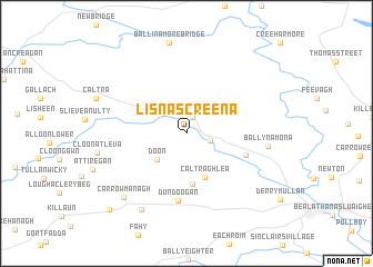
Lisnascreena (Gaillimh, Ireland)Lisnascreena is a town in the Gaillimh region of Ireland. An overview map of the region around Lisnascreena is displayed below.
regional and 3d topo map of Lisnascreena, Ireland ::
Lisnascreena airports ::
The nearest airport is GWY - Galway, located 40.9 km west of Lisnascreena.
Other airports nearby include NOC - Connaught (64.5 km north west), SNN - Shannon (86.8 km south west), SXL - Sligo (99.1 km north), ENK - Enniskillen St Angelo (120.1 km north), Nearby towns ::
Kilglass (1.7km north) //
Áth Eascrach (1.6km south east) //
Ahascragh (1.6km south east) //
Ballybaun (2.4km north west) //
Cornamucklagh (2.8km north east) //
Doon (3.2km south west) //
Caltraghlea (4.6km south) //
Peake (5.1km south) //
Ervallagh Oughter (4.1km south east) //
Dundoogan (6.8km south) //
Ballynamona (5.1km east) //
Kilconnell (8.1km south) //
Cill Chonaill (8.1km south) //
Carrowmanagh (7.5km south west) //
Ballyglass (8.9km south west) //
[all distances 'as the bird flies' and approximate] 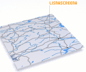 Places with similar names to Lisnascreena, Ireland :: Disclaimer :: Information on this page comes without warranty of any kind |
||
|
Where is Lisnascreena? Elevation and coordinates ::
Latitude (lat): 53°24'6"N Longitude (lon): 8°21'5"W
Elevation (approx.): 52m (map arrows pan, magnifying glasses zoom) |
||
|
Visiting Lisnascreena? Hotel/Accommodation ::
Book a hotel in Lisnascreena Travel Guide ::
Buy a travel guide for Ireland rental cars ::
car rental offers GPS waypoint ::
download a GPX waypoint (PoI) of Lisnascreena for your GPS receiver
|
||