|
search place name
|
||
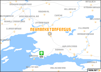
Newmarket on Fergus (An Clár, Ireland)Newmarket on Fergus is a town in the An Clár region of Ireland. An overview map of the region around Newmarket on Fergus is displayed below.
regional and 3d topo map of Newmarket on Fergus, Ireland ::
Newmarket on Fergus airports ::
The nearest airport is SNN - Shannon, located 6.8 km south of Newmarket on Fergus.
Other airports nearby include GWY - Galway (60.2 km north), KIR - Kerry (77.3 km south west), ORK - Cork (105.9 km south), NOC - Connaught (128.1 km north), Nearby towns ::
Cora Chaitlín (0.0km north) //
Ardsollus Bridge (4.2km north) //
Latoon Bridge (4.3km north west) //
Sionainn (6.6km south) //
Shannon (6.6km south) //
Quin (6.8km north) //
Cuinche (6.8km north) //
Noughaval (8.1km north) //
Hurlers Cross (6.6km south east) //
Clarecastle (7.8km north west) //
Droíchead an Chláir (7.8km north west) //
Rineanna (9.3km south west) //
Bunratty East (8.5km south east) //
Bunratty (8.9km south east) //
Bunratty West (10.0km south east) //
[all distances 'as the bird flies' and approximate] 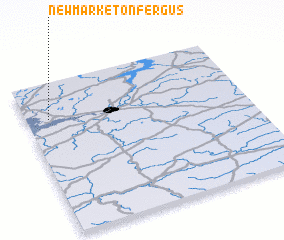 Places with similar names to Newmarket on Fergus, Ireland :: Disclaimer :: Information on this page comes without warranty of any kind |
||
|
Where is Newmarket on Fergus? Elevation and coordinates ::
Latitude (lat): 52°45'36"N Longitude (lon): 8°53'44"W
Elevation (approx.): 17m (map arrows pan, magnifying glasses zoom) |
||
|
Visiting Newmarket on Fergus? Hotel/Accommodation ::
Book a hotel in Newmarket on Fergus Travel Guide ::
Buy a travel guide for Ireland rental cars ::
car rental offers GPS waypoint ::
download a GPX waypoint (PoI) of Newmarket on Fergus for your GPS receiver
|
||