|
search place name
|
||
Northgrove (Laois, Ireland)Northgrove is a town in the Laois region of Ireland. An overview map of the region around Northgrove is displayed below.
regional and 3d topo map of Northgrove, Ireland ::

Northgrove airports ::
The nearest airport is GWY - Galway, located 94.9 km west of Northgrove.
Other airports nearby include SNN - Shannon (96.5 km west), DUB - Dublin (98.9 km north east), WAT - Waterford (99.7 km south), NOC - Connaught (127.4 km north west), Nearby towns ::
Cappanarrow (1.0km south west) //
Camross (2.7km south) //
Monnagh (4.2km south) //
Srahanboy (2.9km west) //
Annagh Bridge (4.7km south east) //
Ballyhorahan (4.5km south east) //
Ballinrally (4.5km south west) //
Inchanisky (4.5km north east) //
Coolrain (5.6km south) //
Derrynase Bridge (5.8km south east) //
Drimmo (4.2km east) //
Letter Cross Roads (7.1km north) //
Glenbower (4.7km east) //
Clonincurragh (5.5km south east) //
Keeloge South (8.5km south) //
Glenletter (8.5km north) //
Pike of Rush Hall (9.1km south) //
[all distances 'as the bird flies' and approximate] 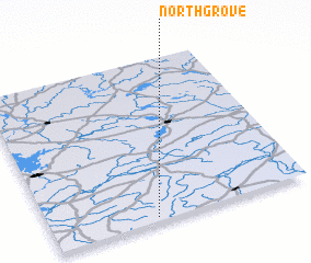 Places with similar names to Northgrove, Ireland ::
// North Grove (US)
Disclaimer :: Information on this page comes without warranty of any kind |
||
|
Where is Northgrove? Elevation and coordinates ::
Latitude (lat): 53°1'39"N Longitude (lon): 7°35'50"W
Elevation (approx.): 179m (map arrows pan, magnifying glasses zoom) |
||
|
Visiting Northgrove? Hotel/Accommodation ::
Book a hotel in Northgrove Travel Guide ::
Buy a travel guide for Ireland rental cars ::
car rental offers GPS waypoint ::
download a GPX waypoint (PoI) of Northgrove for your GPS receiver
|
||