|
search place name
|
||
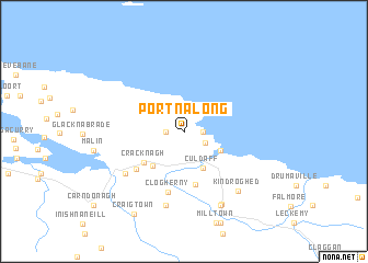
Portnalong (Ireland)Portnalong is a town in Ireland. An overview map of the region around Portnalong is displayed below.
regional and 3d topo map of Portnalong, Ireland ::
Portnalong airports ::
The nearest airport is LDY - Londonderry Eglinton, located 30.5 km south of Portnalong.
Other airports nearby include ILY - Islay (71.3 km north east), BFS - Belfast Aldergrove (96.0 km south east), ENK - Enniskillen St Angelo (106.5 km south), BHD - Belfast City (114.4 km south east), Nearby towns ::
Portaleen (1.1km east) //
Culkeeny (1.1km west) //
Glendooskert (1.9km north) //
Claggan (1.7km south east) //
Portahack (2.8km south east) //
Culdaff (3.9km south) //
Cúil Dabhcha (3.9km south) //
Templemoyle (3.9km south west) //
Cracknagh (3.9km south west) //
Claggan (5.3km south) //
Fahan (4.6km south west) //
Clogherny (6.2km south) //
Drumaville (5.4km south west) //
Gorey (7.5km south) //
Kindroghed (6.8km south east) //
Straruddan (7.7km south) //
Tirraboy (7.7km south) //
Craigtown (8.8km south) //
[all distances 'as the bird flies' and approximate]  Places with similar names to Portnalong, Ireland ::
// Portenläng (DE)
// Port na Long (GB)
Disclaimer :: Information on this page comes without warranty of any kind |
||
|
Where is Portnalong? Elevation and coordinates ::
Latitude (lat): 55°19'0"N Longitude (lon): 7°11'0"W
Elevation (approx.): 47m (map arrows pan, magnifying glasses zoom) |
||
|
Visiting Portnalong? Hotel/Accommodation ::
Book a hotel in Portnalong Travel Guide ::
Buy a travel guide for Ireland rental cars ::
car rental offers GPS waypoint ::
download a GPX waypoint (PoI) of Portnalong for your GPS receiver
|
||