|
search place name
|
||
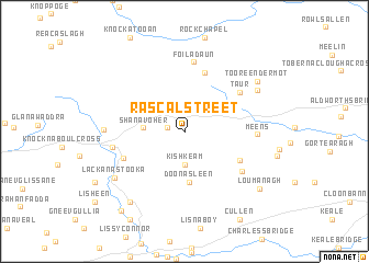
Rascalstreet (Corcaigh, Ireland)Rascalstreet is a town in the Corcaigh region of Ireland. An overview map of the region around Rascalstreet is displayed below.
regional and 3d topo map of Rascalstreet, Ireland ::
Rascalstreet airports ::
The nearest airport is KIR - Kerry, located 24.4 km west of Rascalstreet.
Other airports nearby include SNN - Shannon (58.6 km north), ORK - Cork (61.0 km south east), GWY - Galway (123.7 km north), NOC - Connaught (192.1 km north), Nearby towns ::
Clamper Cross (1.1km west) //
Kishkeam (3.4km south) //
Shanavoher (2.6km west) //
Doonasleen (5.1km south) //
Glasheenanargid (6.1km north) //
Tooreenavuscaun (4.5km south east) //
Glencollins (4.6km south west) //
Taur (5.4km north east) //
Foiladaun (7.0km north) //
Urraghil (5.4km south east) //
Ballydesmond (4.7km west) //
Baile Deasumhan (4.7km west) //
Meens (4.6km east) //
Carriganes (5.1km west) //
Inchantatane (6.2km north east) //
Lackanastooka (6.4km south west) //
Knockyhena (7.8km south west) //
Tooreendermot (6.8km north east) //
Loumanagh (7.4km south east) //
Lisheen Bridge (9.0km south west) //
[all distances 'as the bird flies' and approximate] 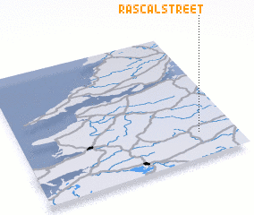 Places with similar names to Rascalstreet, Ireland :: Disclaimer :: Information on this page comes without warranty of any kind |
||
|
Where is Rascalstreet? Elevation and coordinates ::
Latitude (lat): 52°11'49"N Longitude (lon): 9°10'5"W
Elevation (approx.): 218m (map arrows pan, magnifying glasses zoom) |
||
|
Visiting Rascalstreet? Hotel/Accommodation ::
Book a hotel in Rascalstreet Travel Guide ::
Buy a travel guide for Ireland rental cars ::
car rental offers GPS waypoint ::
download a GPX waypoint (PoI) of Rascalstreet for your GPS receiver
|
||