|
search place name
|
||
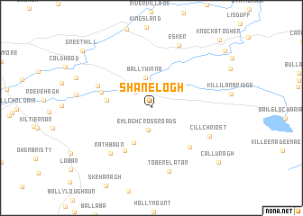
Shanelogh (Gaillimh, Ireland)Shanelogh is a town in the Gaillimh region of Ireland. An overview map of the region around Shanelogh is displayed below.
regional and 3d topo map of Shanelogh, Ireland ::
Shanelogh airports ::
The nearest airport is GWY - Galway, located 18.2 km north west of Shanelogh.
Other airports nearby include SNN - Shannon (58.1 km south), NOC - Connaught (78.4 km north), SXL - Sligo (119.5 km north), KIR - Kerry (126.7 km south west), Nearby towns ::
Ballymore (2.4km north west) //
Craughwell (2.3km north west) //
Creachmhaoil (2.3km north west) //
Emlagh Cross Roads (2.8km south) //
Caherkinmonwee (2.9km north) //
Ballywinna (3.8km north) //
Fiddaun (4.5km south) //
Carrigeen (3.5km west) //
Moneen East (5.7km south) //
Shanbally (4.2km north west) //
The Fishpond Cross Roads (5.6km south east) //
Cahefurvan (4.8km north west) //
Rathbaun (6.4km south west) //
Cill Chríost (5.6km south east) //
Kilchreest (5.6km south east) //
Toberelatan (8.0km south) //
Esker (8.0km north) //
Calluragh (8.4km south east) //
Greethill (8.8km north west) //
Knockatogher (9.8km north east) //
[all distances 'as the bird flies' and approximate] 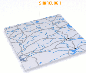 Places with similar names to Shanelogh, Ireland ::
// Chanilovo (RU)
// Channelview (US)
Disclaimer :: Information on this page comes without warranty of any kind |
||
|
Where is Shanelogh? Elevation and coordinates ::
Latitude (lat): 53°12'30"N Longitude (lon): 8°42'57"W
Elevation (approx.): 44m (map arrows pan, magnifying glasses zoom) |
||
|
Visiting Shanelogh? Hotel/Accommodation ::
Book a hotel in Shanelogh Travel Guide ::
Buy a travel guide for Ireland rental cars ::
car rental offers GPS waypoint ::
download a GPX waypoint (PoI) of Shanelogh for your GPS receiver
|
||