|
search place name
|
||
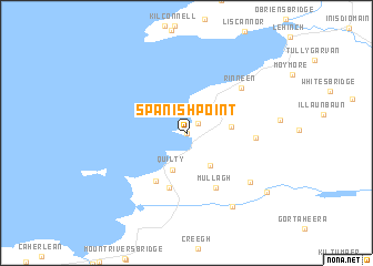
Spanish Point (An Clár, Ireland)Spanish Point is a town in the An Clár region of Ireland. An overview map of the region around Spanish Point is displayed below.
regional and 3d topo map of Spanish Point, Ireland ::
Spanish Point airports ::
The nearest airport is SNN - Shannon, located 38.3 km south east of Spanish Point.
Other airports nearby include GWY - Galway (60.2 km north east), KIR - Kerry (74.7 km south), NOC - Connaught (125.0 km north), ORK - Cork (129.4 km south east), Nearby towns ::
Rinn na Spáinneach (0.0km north) //
Cleedagh Bridge (1.2km north east) //
Quilty (3.7km south) //
Ahnagh Cross (3.5km south east) //
Sráid na Cathrach (2.7km east) //
Milltown Malbay (2.7km east) //
Tromra (5.1km south) //
Kilmurry (5.5km south) //
Mullagh (5.7km south) //
Mullach (5.7km south) //
Hoganʼs Bridge (4.2km east) //
Rinneen (5.6km north east) //
Drehidnaraga Bridge (6.2km south east) //
Knocknahila Bridge (7.8km south) //
Moyglass Bridge (7.6km south east) //
[all distances 'as the bird flies' and approximate] 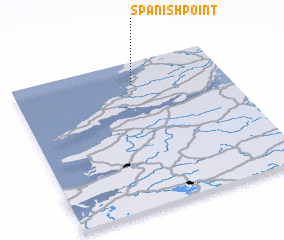 Places with similar names to Spanish Point, Ireland :: Disclaimer :: Information on this page comes without warranty of any kind |
||
|
Where is Spanish Point? Elevation and coordinates ::
Latitude (lat): 52°50'59"N Longitude (lon): 9°26'17"W
Elevation (approx.): 15m (map arrows pan, magnifying glasses zoom) |
||
|
Visiting Spanish Point? Hotel/Accommodation ::
Book a hotel in Spanish Point Travel Guide ::
Buy a travel guide for Ireland rental cars ::
car rental offers GPS waypoint ::
download a GPX waypoint (PoI) of Spanish Point for your GPS receiver
|
||