|
search place name
|
||
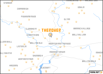
The Rower (Cill Chainnigh, Ireland)The Rower is a town in the Cill Chainnigh region of Ireland. An overview map of the region around The Rower is displayed below.
regional and 3d topo map of The Rower, Ireland ::
The Rower airports ::
The nearest airport is WAT - Waterford, located 31.1 km south of The Rower.
Other airports nearby include DUB - Dublin (117.0 km north east), ORK - Cork (125.3 km south west), SNN - Shannon (136.2 km west), GWY - Galway (163.4 km north west), Nearby towns ::
Tinnascolly (1.3km south east) //
Kiltown Cross Roads (1.5km west) //
Mount Garrett Bridge (4.0km south east) //
Ballygub (3.8km north west) //
Saint Mullins (4.7km north east) //
Ballyanne (4.4km south east) //
Rosbercon (6.2km south) //
Ballyneale (4.7km south west) //
Pollmounty Bridge (4.1km east) //
Ballyknock (5.2km south west) //
Dysertmore (4.1km west) //
New Ross (6.7km south) //
Ros Mhic Thriúin (6.7km south) //
Clonamery (4.8km north west) //
Glynn (6.4km north east) //
Glenballyvally (5.3km west) //
Ballyreddy (6.8km south west) //
Shunbagh (8.4km south) //
Fiddaun Bridge (8.0km north west) //
Busherstown (9.9km south west) //
[all distances 'as the bird flies' and approximate] 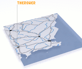 Places with similar names to The Rower, Ireland ::
// Tharewāri (PK)
Disclaimer :: Information on this page comes without warranty of any kind |
||
|
Where is The Rower? Elevation and coordinates ::
Latitude (lat): 52°27'20"N Longitude (lon): 6°57'25"W
Elevation (approx.): 109m (map arrows pan, magnifying glasses zoom) |
||
|
Visiting The Rower? Hotel/Accommodation ::
Book a hotel in The Rower Travel Guide ::
Buy a travel guide for Ireland rental cars ::
car rental offers GPS waypoint ::
download a GPX waypoint (PoI) of The Rower for your GPS receiver
|
||