|
search place name
|
||
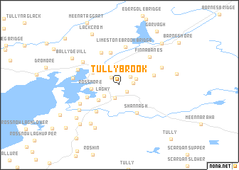
Tullybrook (Donegal, Ireland)Tullybrook is a town in the Donegal region of Ireland. An overview map of the region around Tullybrook is displayed below.
regional and 3d topo map of Tullybrook, Ireland ::
Tullybrook airports ::
The nearest airport is ENK - Enniskillen St Angelo, located 37.9 km south east of Tullybrook.
Other airports nearby include SXL - Sligo (51.7 km south west), LDY - Londonderry Eglinton (74.6 km north east), NOC - Connaught (93.7 km south west), BFS - Belfast Aldergrove (120.3 km east), Nearby towns ::
Raneany Bridge (1.3km south east) //
Carterʼs Bridge (1.4km north west) //
Drumbar (1.7km north east) //
Carrick Bridge (2.1km south) //
Moyne Bridge (1.3km east) //
Lackan (1.8km north east) //
An Lathaigh (2.2km south west) //
Laghy (2.2km south west) //
Carrick (3.1km south west) //
Rossmore (2.7km west) //
Drummenny Bridge (3.6km north east) //
Donegal (3.2km north west) //
Dún na nGall (3.2km north west) //
Shannagh (4.6km south) //
Winterhill (5.1km north) //
Rossillybeg (3.5km south west) //
Bridgetown (4.7km south west) //
Copan (3.5km north east) //
Deningornan Bridge (5.4km north) //
Limestone Brook Bridge (6.0km north) //
Finnabanes (5.2km north east) //
Red Bridges (4.9km north west) //
Mullanasole (4.7km south west) //
Murlas Bridge (4.5km north west) //
Aghlem Bridge (4.7km north east) //
Ballyboyle (4.3km west) //
Drunickory (5.4km south west) //
Baile an tSratha (6.7km south west) //
Ballintra (6.7km south west) //
[all distances 'as the bird flies' and approximate] 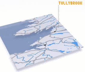 Places with similar names to Tullybrook, Ireland ::
Disclaimer :: Information on this page comes without warranty of any kind |
||
|
Where is Tullybrook? Elevation and coordinates ::
Latitude (lat): 54°37'55"N Longitude (lon): 8°4'44"W
Elevation (approx.): 37m (map arrows pan, magnifying glasses zoom) |
||
|
Visiting Tullybrook? Hotel/Accommodation ::
Book a hotel in Tullybrook Travel Guide ::
Buy a travel guide for Ireland rental cars ::
car rental offers GPS waypoint ::
download a GPX waypoint (PoI) of Tullybrook for your GPS receiver
|
||