|
search place name
|
||
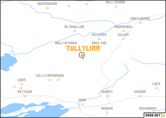
Tullylinn (Donegal, Ireland)Tullylinn is a town in the Donegal region of Ireland. An overview map of the region around Tullylinn is displayed below.
regional and 3d topo map of Tullylinn, Ireland ::
Tullylinn airports ::
The nearest airport is ENK - Enniskillen St Angelo, located 25.5 km south of Tullylinn.
Other airports nearby include LDY - Londonderry Eglinton (58.6 km north east), SXL - Sligo (69.0 km south west), BFS - Belfast Aldergrove (96.9 km east), NOC - Connaught (107.2 km south west), Nearby towns ::
The Rock (3.4km north east) //
Ballyetragh (3.5km north west) //
Killeter (5.0km north east) //
Altamullan (6.6km north) //
Tievemore (5.7km south west) //
Tullylark Bridge (6.3km south west) //
Ederny (8.9km south) //
[all distances 'as the bird flies' and approximate]  Places with similar names to Tullylinn, Ireland ::
// Dalālān (IQ)
// Dalālan (IR)
// Daulalan (TP)
// Taloulun (ID)
// Toulou Lani (NE)
// Tilālayn (SY)
// Ţlīlīn (SY)
// Delelane (MZ)
// Tlaloun (MA)
// Tall ‘Aylūn (SY)
Disclaimer :: Information on this page comes without warranty of any kind |
||
|
Where is Tullylinn? Elevation and coordinates ::
Latitude (lat): 54°37'31"N Longitude (lon): 7°42'56"W
Elevation (approx.): 202m (map arrows pan, magnifying glasses zoom) |
||
|
Visiting Tullylinn? Hotel/Accommodation ::
Book a hotel in Tullylinn Travel Guide ::
Buy a travel guide for Ireland rental cars ::
car rental offers GPS waypoint ::
download a GPX waypoint (PoI) of Tullylinn for your GPS receiver
|
||