|
search place name
|
||
Anita (Istarska Županija, Croatia)Anita is a town in the Istarska Županija region of Croatia. An overview map of the region around Anita is displayed below.
regional and 3d topo map of Anita, Croatia ::

Anita airports ::
The nearest airport is POW - Portoroz, located 36.6 km north of Anita.
Other airports nearby include PUY - Pula (37.8 km south east), TRS - Ronchi De Legionari Ronchi Dei Legionari (76.6 km north), RJK - Rijeka (77.0 km east), VCE - Venice Venezia Tessera (105.5 km north west), Nearby towns ::
Vrsar (0.9km north east) //
Stancija Valkanela (1.8km north east) //
Funtana (3.5km north) //
Coki (3.7km north) //
Zelena Laguna (5.7km north) //
Mugeba (5.6km north) //
Božić (6.3km north) //
Fuškulin (5.4km north east) //
Plava Laguna (7.2km north) //
Jasenovica (6.0km north east) //
Sveti Duh (8.1km north) //
Flengi (6.0km east) //
Valkarin (7.7km north east) //
Rovinj (7.9km south east) //
Mušalež (8.4km north east) //
Štanga (8.3km south east) //
Dračevac (7.5km north east) //
Polari (10.5km south east) //
[all distances 'as the bird flies' and approximate] 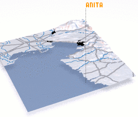 Places with similar names to Anita, Croatia ::
Disclaimer :: Information on this page comes without warranty of any kind |
||
|
Where is Anita? Elevation and coordinates ::
Latitude (lat): 45°8'38"N Longitude (lon): 13°35'48"E
Elevation (approx.): -32768m (map arrows pan, magnifying glasses zoom) |
||
|
Visiting Anita? Hotel/Accommodation ::
Book a hotel in Anita Travel Guide ::
Buy a travel guide for Croatia rental cars ::
car rental offers GPS waypoint ::
download a GPX waypoint (PoI) of Anita for your GPS receiver
|
||