|
search place name
|
||
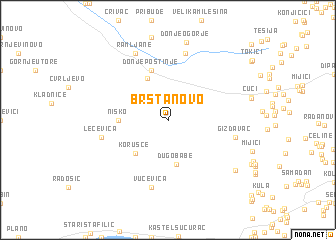
Brštanovo (Croatia)Brštanovo is a town in Croatia. An overview map of the region around Brštanovo is displayed below.
regional and 3d topo map of Brštanovo, Croatia ::
Brštanovo airports ::
The nearest airport is SPU - Split, located 17.1 km south west of Brštanovo.
Other airports nearby include ZAD - Zadar (99.0 km north west), OMO - Mostar (123.2 km east), SJJ - Sarajevo (155.2 km east), DBV - Dubrovnik (194.4 km south east), Nearby towns ::
Dugobabe (5.0km south) //
Gornje Postinje (4.9km north) //
Korušce (4.6km south west) //
Nisko (4.0km west) //
Donje Postinje (5.7km north) //
Radunić (7.5km north) //
Gizdavac (5.7km east) //
Lećevica (5.7km west) //
Vučevica (7.5km south) //
Ramljane (7.9km north) //
Donje Ogorje (8.7km north) //
Veliki Broćanac (7.7km south east) //
[all distances 'as the bird flies' and approximate] 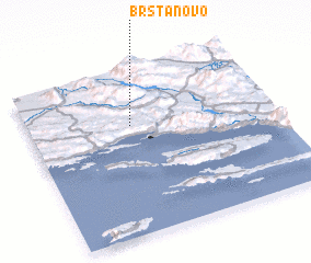 Places with similar names to Brštanovo, Croatia ::
// Bersteneva (RU)
Disclaimer :: Information on this page comes without warranty of any kind |
||
|
Where is Brštanovo? Elevation and coordinates ::
Latitude (lat): 43°40'0"N Longitude (lon): 16°25'0"E
Elevation (approx.): 528m (map arrows pan, magnifying glasses zoom) |
||
|
Visiting Brštanovo? Hotel/Accommodation ::
Book a hotel in Brštanovo Travel Guide ::
Buy a travel guide for Croatia rental cars ::
car rental offers GPS waypoint ::
download a GPX waypoint (PoI) of Brštanovo for your GPS receiver
|
||