|
search place name
|
||
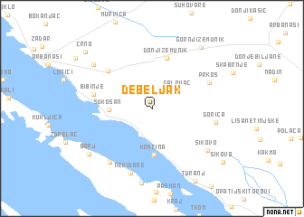
Debeljak (Croatia)Debeljak is a town in Croatia. An overview map of the region around Debeljak is displayed below.
regional and 3d topo map of Debeljak, Croatia ::
Debeljak airports ::
The nearest airport is ZAD - Zadar, located 6.5 km north of Debeljak.
Other airports nearby include SPU - Split (94.2 km south east), RJK - Rijeka (144.1 km north west), PUY - Pula (148.1 km north west), ZAG - Zagreb (196.1 km north), Nearby towns ::
Galovac (3.2km north east) //
Sukošan (3.8km west) //
Krmčina (5.7km south) //
Donji Zemunik (6.3km north) //
Babin Dub Pločanski (6.1km north west) //
Bibinje (5.5km west) //
Prkos (6.0km north east) //
Gorica (5.8km east) //
Neviđane (8.1km south) //
Dobropoljana (7.6km south west) //
Sikovo (7.0km south east) //
Dračevac Zadarski (7.5km north west) //
Banj (7.9km south west) //
Gornji Zemunik (8.7km north east) //
Turanj (9.6km south east) //
Crno (9.2km north west) //
Sikovo (9.0km south east) //
[all distances 'as the bird flies' and approximate] 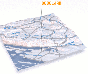 Places with similar names to Debeljak, Croatia ::
Disclaimer :: Information on this page comes without warranty of any kind |
||
|
Where is Debeljak? Elevation and coordinates ::
Latitude (lat): 44°3'4"N Longitude (lon): 15°21'53"E
Elevation (approx.): 93m (map arrows pan, magnifying glasses zoom) |
||
|
Visiting Debeljak? Hotel/Accommodation ::
Book a hotel in Debeljak Travel Guide ::
Buy a travel guide for Croatia rental cars ::
car rental offers GPS waypoint ::
download a GPX waypoint (PoI) of Debeljak for your GPS receiver
|
||