|
search place name
|
||
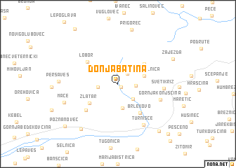
Donja Batina (Croatia)Donja Batina is a town in Croatia. An overview map of the region around Donja Batina is displayed below.
regional and 3d topo map of Donja Batina, Croatia ::
Donja Batina airports ::
The nearest airport is ZAG - Zagreb, located 42.2 km south of Donja Batina.
Other airports nearby include MBX - Maribor (51.6 km north west), GRZ - Graz (109.6 km north west), LJU - Ljubliana Ljubljana (128.3 km west), KLU - Klagenfurt (Worthersee Intl) (148.3 km north west), Nearby towns ::
Gornja Batina (0.6km south east) //
Belec (1.9km north east) //
Petruševec (2.0km east) //
Martinšćina (2.7km north west) //
Ratkovec Zlatarski (2.3km west) //
Delovi (2.9km south east) //
Ervenik (3.9km south) //
Donja Selnica (3.2km north east) //
Gornja Selnica (4.3km north east) //
Zlatar (4.4km south west) //
Brlekovo (5.3km south east) //
Lobor (4.9km north west) //
Martinci Zlatarski (5.5km south west) //
Vrbovo (5.5km south west) //
Gornja Konjšćina (5.3km south east) //
Sveti Križ (5.1km east) //
Turnišće (7.2km south east) //
Prigorec (8.8km north) //
Mače (6.6km south west) //
Lovrečan (8.3km south west) //
Zajezda (7.2km north east) //
Donja Konjšćina (8.8km south east) //
Poznanovec (8.9km south west) //
Stari Golubovec (10.0km north west) //
Jelovec (9.7km south east) //
[all distances 'as the bird flies' and approximate]  Places with similar names to Donja Batina, Croatia ::
// Donji Botun (BA)
// Tiengeboden (NL)
Disclaimer :: Information on this page comes without warranty of any kind |
||
|
Where is Donja Batina? Elevation and coordinates ::
Latitude (lat): 46°7'17"N Longitude (lon): 16°6'43"E
Elevation (approx.): 228m (map arrows pan, magnifying glasses zoom) |
||
|
Visiting Donja Batina? Hotel/Accommodation ::
Book a hotel in Donja Batina Travel Guide ::
Buy a travel guide for Croatia rental cars ::
car rental offers GPS waypoint ::
download a GPX waypoint (PoI) of Donja Batina for your GPS receiver
|
||