|
search place name
|
||
Donji Šajn (Primorsko-Goranska Županija, Croatia)Donji Šajn is a town in the Primorsko-Goranska Županija region of Croatia. An overview map of the region around Donji Šajn is displayed below.
regional and 3d topo map of Donji Šajn, Croatia ::

Donji Šajn airports ::
The nearest airport is RJK - Rijeka, located 43.3 km south west of Donji Šajn.
Other airports nearby include ZAG - Zagreb (90.5 km east), LJU - Ljubliana Ljubljana (90.8 km north west), PUY - Pula (105.4 km south west), POW - Portoroz (105.7 km west), Nearby towns ::
Gornji Šajn (1.0km north) //
Brod Moravice (2.6km south) //
Šimatovo (2.8km north west) //
Vele Drage (3.4km south east) //
Zrnovac (4.6km south west) //
Novi Lazi (5.1km south) //
Kupa (4.1km west) //
Male Drage (4.6km south east) //
Stari Lazi (6.1km south) //
Sapnik (4.5km west) //
(( Muha Vas )) (6.0km north west) //
Divjake (6.8km south west) //
Razdrto (5.2km east) //
Spodnji Log (6.3km north east) //
Vrh pri Fari (5.3km west) //
Bukov Vrh (8.1km south) //
Škrilj (7.4km north west) //
Knežja Lipa (7.9km north east) //
Nova Sela (6.4km west) //
Rajndol (8.9km north) //
Skrad (8.0km south west) //
Srpske Moravice (8.0km south east) //
Svetli Potok (9.5km north east) //
Vučinić Selo (9.5km south east) //
Rogati Hrib (10.0km north west) //
Nemška Loka (9.9km north east) //
[all distances 'as the bird flies' and approximate] 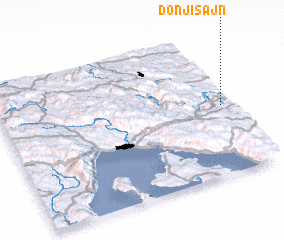 Places with similar names to Donji Šajn, Croatia :: Disclaimer :: Information on this page comes without warranty of any kind |
||
|
Where is Donji Šajn? Elevation and coordinates ::
Latitude (lat): 45°29'18"N Longitude (lon): 14°58'0"E
Elevation (approx.): 546m (map arrows pan, magnifying glasses zoom) |
||
|
Visiting Donji Šajn? Hotel/Accommodation ::
Book a hotel in Donji Šajn Travel Guide ::
Buy a travel guide for Croatia rental cars ::
car rental offers GPS waypoint ::
download a GPX waypoint (PoI) of Donji Šajn for your GPS receiver
|
||