|
search place name
|
||
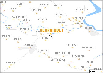
Henrikovci (Croatia)Henrikovci is a town in Croatia. An overview map of the region around Henrikovci is displayed below.
regional and 3d topo map of Henrikovci, Croatia ::
Henrikovci airports ::
The nearest airport is OSI - Osijek, located 16.2 km north of Henrikovci.
Other airports nearby include BEG - Beograd (126.1 km south east), SJJ - Sarajevo (172.2 km south), Nearby towns ::
Cerić (2.2km south west) //
Marinci (2.5km north east) //
Nuštar (2.8km west) //
Bršadin (5.0km north east) //
Pačetin (5.8km north west) //
Bogdanovci (4.6km north east) //
Mirkovci (6.4km south) //
Vodica (7.4km south) //
Lipovača (7.5km north) //
Stari Jankovci (7.6km south east) //
Vrapče (7.9km south west) //
Petrovci (6.7km south east) //
Vinkovci (6.9km south west) //
Lipovački Put (7.8km north east) //
Trpinjska Cesta (7.8km north east) //
Kriva Bara (7.6km north east) //
Ludvinci (9.5km north west) //
Borovska Cesta (8.7km north east) //
Borovo Naselje (8.6km north east) //
[all distances 'as the bird flies' and approximate] 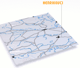 Places with similar names to Henrikovci, Croatia :: Disclaimer :: Information on this page comes without warranty of any kind |
||
|
Where is Henrikovci? Elevation and coordinates ::
Latitude (lat): 45°19'29"N Longitude (lon): 18°52'34"E
Elevation (approx.): 91m (map arrows pan, magnifying glasses zoom) |
||
|
Visiting Henrikovci? Hotel/Accommodation ::
Book a hotel in Henrikovci Travel Guide ::
Buy a travel guide for Croatia rental cars ::
car rental offers GPS waypoint ::
download a GPX waypoint (PoI) of Henrikovci for your GPS receiver
|
||