|
search place name
|
||
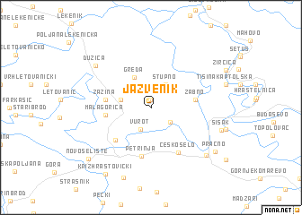
Jazvenik (Sisačko-Moslavačka Županija, Croatia)Jazvenik is a town in the Sisačko-Moslavačka Županija region of Croatia. An overview map of the region around Jazvenik is displayed below.
regional and 3d topo map of Jazvenik, Croatia ::
Jazvenik airports ::
The nearest airport is ZAG - Zagreb, located 33.3 km north west of Jazvenik.
Other airports nearby include MBX - Maribor (119.8 km north west), RJK - Rijeka (139.0 km west), LJU - Ljubliana Ljubljana (164.7 km north west), ZAD - Zadar (171.2 km south west), Nearby towns ::
Sela (1.0km north) //
Stara Drenčina (2.4km south east) //
Vurot (2.8km south) //
Stupno (3.1km north east) //
Petrovec (2.8km west) //
Greda (4.0km north) //
Žabno (4.0km east) //
Odra Sisačka (4.0km east) //
Mala Gorica (4.0km west) //
Žažina (4.1km west) //
Brest Pokupski (5.1km south west) //
Petrinja (6.0km south) //
Česko Selo (6.0km south east) //
Dužica (7.1km north west) //
Mošćenica (7.5km south east) //
Sisak (6.7km south east) //
Cepeliš (9.0km south) //
Pračno (7.7km south east) //
Križ Hrastovički (9.2km south west) //
Novo Selište (8.4km south west) //
[all distances 'as the bird flies' and approximate] 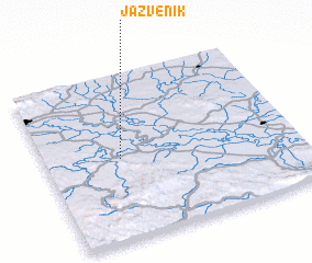 Places with similar names to Jazvenik, Croatia ::
Disclaimer :: Information on this page comes without warranty of any kind |
||
|
Where is Jazvenik? Elevation and coordinates ::
Latitude (lat): 45°29'28"N Longitude (lon): 16°18'2"E
Elevation (approx.): 118m (map arrows pan, magnifying glasses zoom) |
||
|
Visiting Jazvenik? Hotel/Accommodation ::
Book a hotel in Jazvenik Travel Guide ::
Buy a travel guide for Croatia rental cars ::
car rental offers GPS waypoint ::
download a GPX waypoint (PoI) of Jazvenik for your GPS receiver
|
||