|
search place name
|
||
Otok (Croatia)Otok is a town in Croatia. An overview map of the region around Otok is displayed below.
regional and 3d topo map of Otok, Croatia ::

Otok airports ::
The nearest airport is OMO - Mostar, located 43.0 km north east of Otok.
Other airports nearby include DBV - Dubrovnik (79.6 km south east), SPU - Split (114.4 km north west), SJJ - Sarajevo (114.5 km north east), TIV - Tivat (120.2 km south east), Nearby towns ::
Mihalj (0.6km south east) //
Otok Trn (0.8km north west) //
Otok Trn (1.4km north) //
Dračeva Luka (1.2km west) //
Blace (1.3km north west) //
Duba (1.8km south) //
Tuštavac (1.7km south east) //
Brijeg (2.7km south) //
Kremena (2.8km south) //
Raba (3.0km south east) //
Lovorje (3.3km south east) //
Kupinovac (3.7km south east) //
Novo Naselje (3.4km east) //
Pižnovac (3.6km south east) //
Lađište (4.3km east) //
Stolovi (5.0km south east) //
Banja (6.1km north) //
Rogotin (6.2km north) //
Ploča (5.0km south east) //
Podučiji Brig (6.4km north) //
Šarića Struga (6.4km north) //
Rat (6.1km south west) //
Modro Oko (6.8km north) //
Slivno Ravno (5.7km south east) //
Podgradina (5.2km east) //
Komin (6.3km north east) //
Komarna (6.4km south east) //
Istočna Plina (7.0km north) //
Dančanje (5.3km east) //
[all distances 'as the bird flies' and approximate] 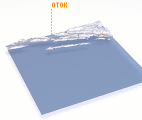 Places with similar names to Otok, Croatia ::
Disclaimer :: Information on this page comes without warranty of any kind |
||
|
Where is Otok? Elevation and coordinates ::
Latitude (lat): 42°59'40"N Longitude (lon): 17°29'36"E
Elevation (approx.): 2m (map arrows pan, magnifying glasses zoom) |
||
|
Visiting Otok? Hotel/Accommodation ::
Book a hotel in Otok Travel Guide ::
Buy a travel guide for Croatia rental cars ::
car rental offers GPS waypoint ::
download a GPX waypoint (PoI) of Otok for your GPS receiver
|
||