|
search place name
|
||
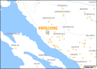
Pandžinac (Croatia)Pandžinac is a town in Croatia. An overview map of the region around Pandžinac is displayed below.
regional and 3d topo map of Pandžinac, Croatia ::
Pandžinac airports ::
The nearest airport is ZAD - Zadar, located 61.8 km south east of Pandžinac.
Other airports nearby include RJK - Rijeka (75.9 km north west), PUY - Pula (91.2 km west), POW - Portoroz (145.6 km north west), ZAG - Zagreb (151.7 km north east), Nearby towns ::
Karaule (1.3km south east) //
(( Žuta Lokva )) (1.7km south) //
Smojveri (1.8km south) //
Čačići (2.4km south) //
Radlovac (2.0km north east) //
Trolokve (3.1km south) //
Zelenike (3.1km south) //
Mlinište (3.2km north east) //
Podgora (2.6km east) //
Prizna (4.1km north) //
Jasenovača (3.1km east) //
Guvnine (4.3km south) //
(( Blizanci )) (4.4km south) //
Pejakuša (3.7km south east) //
Starčević Dolac (4.9km north) //
Dokozići (4.7km south east) //
Vrbanska Duliba (3.8km east) //
Jurčić Dolac (5.3km north) //
Cesarica (5.1km south) //
(( Vrbani )) (5.3km south east) //
Matić Podi (5.5km south east) //
Skorpovac (4.5km east) //
Plitka Draga (6.4km south east) //
Ribarica (6.9km south east) //
Kugina Kuća (5.9km east) //
(( Crni Padež )) (8.4km north east) //
(( Javanović Padež )) (8.8km north east) //
Staništa (8.3km south east) //
Karlobag (10.5km south east) //
[all distances 'as the bird flies' and approximate]  Places with similar names to Pandžinac, Croatia ::
// Pontseng (ZA)
// Pandzangué II (TD)
Disclaimer :: Information on this page comes without warranty of any kind |
||
|
Where is Pandžinac? Elevation and coordinates ::
Latitude (lat): 44°36'21"N Longitude (lon): 15°0'1"E
Elevation (approx.): 445m (map arrows pan, magnifying glasses zoom) |
||
|
Visiting Pandžinac? Hotel/Accommodation ::
Book a hotel in Pandžinac Travel Guide ::
Buy a travel guide for Croatia rental cars ::
car rental offers GPS waypoint ::
download a GPX waypoint (PoI) of Pandžinac for your GPS receiver
|
||