|
search place name
|
||
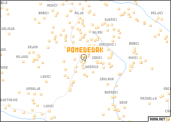
Pomeđeđak (Croatia)Pomeđeđak is a town in Croatia. An overview map of the region around Pomeđeđak is displayed below.
regional and 3d topo map of Pomeđeđak, Croatia ::
Pomeđeđak airports ::
The nearest airport is ZAD - Zadar, located 69.0 km south west of Pomeđeđak.
Other airports nearby include SPU - Split (92.5 km south), ZAG - Zagreb (153.4 km north), RJK - Rijeka (156.0 km north west), OMO - Mostar (182.6 km south east), Nearby towns ::
Mrkonjići (0.4km south west) //
Srb (0.7km west) //
Glavice (0.9km south west) //
Kruškovače (1.2km north) //
Donji Srb (1.2km north west) //
Desnice (1.5km south) //
Ristići (1.7km north) //
Raštele (1.8km north) //
Gornji Srb (2.0km south west) //
Podastrana (1.8km west) //
Grbići (1.8km east) //
Zorići (1.9km east) //
Vojvodići (2.4km north west) //
Desnice (2.6km south east) //
Kunovac Kupirovački (3.0km south) //
Tomići (3.0km north) //
Rađenovići (3.0km north) //
Podurljaj (2.7km south west) //
Ugrice (3.3km south) //
Savići (2.4km east) //
Neteka (3.0km north west) //
Bosanski Osredci (3.0km north east) //
Rodići (3.5km north) //
Šušići (3.6km north) //
Karaula (2.8km east) //
Škonpići (3.7km north east) //
Osredci (3.2km south east) //
Pilipovići (4.4km north) //
Ajđerovac (3.4km west) //
[all distances 'as the bird flies' and approximate]  Places with similar names to Pomeđeđak, Croatia :: Disclaimer :: Information on this page comes without warranty of any kind |
||
|
Where is Pomeđeđak? Elevation and coordinates ::
Latitude (lat): 44°21'48"N Longitude (lon): 16°8'5"E
Elevation (approx.): 424m (map arrows pan, magnifying glasses zoom) |
||
|
Visiting Pomeđeđak? Hotel/Accommodation ::
Book a hotel in Pomeđeđak Travel Guide ::
Buy a travel guide for Croatia rental cars ::
car rental offers GPS waypoint ::
download a GPX waypoint (PoI) of Pomeđeđak for your GPS receiver
|
||