|
search place name
|
||
Ruševo (Croatia)Ruševo is a town in Croatia. An overview map of the region around Ruševo is displayed below.
regional and 3d topo map of Ruševo, Croatia ::

Ruševo airports ::
The nearest airport is OSI - Osijek, located 65.2 km east of Ruševo.
Other airports nearby include ZAG - Zagreb (158.7 km west), SJJ - Sarajevo (167.3 km south), SPU - Split (239.4 km south west), Nearby towns ::
Ruševo (1.0km west) //
Migalovci (2.1km north) //
Sovski Dol (2.9km east) //
Čaglin (4.4km north) //
Ivanovci Požeški (3.7km north west) //
Kneževac (4.9km north east) //
Matković Mala (5.8km south) //
Djedina Rijeka (4.2km west) //
Dubovik (6.2km south) //
Gornji Slatinik (5.9km south) //
Darkovac (6.3km north) //
Sapna (6.2km north) //
Donji Slatinik (6.5km south) //
Paka (5.0km south east) //
Latinovac (5.6km north west) //
Donji Jasik (6.7km north) //
Oriovčić (6.8km south) //
Milan-Lug (6.8km north) //
Jurkovac (7.6km north) //
Šibokovac (6.8km north east) //
Gornji Jasik (8.0km north) //
Nova Ljeskovica (8.3km north) //
Dobrogošće (6.2km east) //
Brodski Zdenci (7.4km south west) //
Veliki Bilač (6.3km west) //
Vlatkovac (7.2km north east) //
Duboka (8.9km north) //
Petrakovi (9.0km south) //
Glogovica (9.2km south) //
[all distances 'as the bird flies' and approximate] 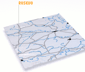 Places with similar names to Ruševo, Croatia ::
Disclaimer :: Information on this page comes without warranty of any kind |
||
|
Where is Ruševo? Elevation and coordinates ::
Latitude (lat): 45°18'43"N Longitude (lon): 18°0'22"E
Elevation (approx.): 163m (map arrows pan, magnifying glasses zoom) |
||
|
Visiting Ruševo? Hotel/Accommodation ::
Book a hotel in Ruševo Travel Guide ::
Buy a travel guide for Croatia rental cars ::
car rental offers GPS waypoint ::
download a GPX waypoint (PoI) of Ruševo for your GPS receiver
|
||